 World Settlement Footprint (WSF) Tracker - Global, 2016-2026
| The WSF Tracker is a global dataset designed to outline how built-up areas evolve over time. Developed through collaboration between the German Aerospace Center (DLR) and MindEarth, with support from a dedicated initiative of the European Space Agency's (ESA) Global Development Assistance (GDA) programme, the WSF Tracker captures settlement changes worldwide every six months at 10 m resolution since July 2016. Until now, global settlement maps have largely functioned as static snapshots, capturing where built-up areas existed at a given moment but offering limited visibility into how they evolved over time. The WSF Tracker changes this by creating a continuously updated global record of settlement dynamics.By analysing satellite observations from the European Sentinel-1 and Sentinel-2 missions and combining it with auxilary data likes dems and roand networks the dataset provides a spatially detailed and frequently updated picture of built-up area development at a scale that has so far been largely unavailable globally. | ||
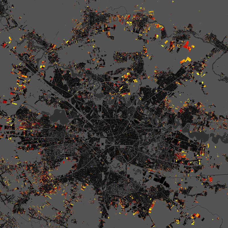 |
||
| Suggested Data Citation | ||
| German Aerospace Center (DLR) (2026): World Settlement Footprint (WSF) - Global, 2016-2026. https://doi.org/10.15489/3fa4d2j0tk78 | ||
| Coverage | ||
| Geographic Boundaries | ||
| North: | 78.00° | |
| West: | -180.00° | |
| East: | 180.00° | |
| South: | -60.00° | |
| Time Period | ||
| Start date: | 2016-06-01 | |
| End date: | 2026-01-01 | |
| More Information | ||
| Keywords: | DLR, EOC, Sentinel-1/2, Copernicus, ESA, urbanization, urban growth, global settlements, GDA, opendata | |
| Contact: | wsf@dlr.de | |
| Access / Use Restriction: | License | |
| Data Use Guidelines | Creative Commons BY 4.0 | |
| Links | ||
| Mission / Project Information | ||
| DOI (of Dataset) | https://doi.org/10.15489/3fa4d2j0tk78 Digital Object Identifier |
|
| EOC Geoservice Dataset Landing Page | https://geoservice.dlr.de/web/datasets/wsf_tracker Dataset Landing Page |
|
| Downloading Data | ||
| HTTP Download (WSF Tracker) | https://download.geoservice.dlr.de/WSFTRACKER/files/ HTTP Download |
|