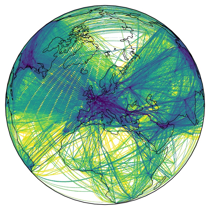
| This dataset contains a global gridded distribution of emissions for the aviation sector as annual and hourly means for year 2019 and has been developed by DLR within the project EmissionsLandKarte (ELK). The methodology is based on a bottom-up approach of a global weekly flight plan for summer and winter season. Modeled aircraft trajectories followed the total energy model and used BADA aircraft performance data, emissions were derived with fuel flow correlation methods and emission factors from ICAO Aircraft Engine Emissions Databank. | ||
 |
||
| Suggested Data Citation | ||
| Data: Weder, C. M., Berster, P., Clococeanu, M., Gelhausen, M., Lau, A., Linke, F., Matthes, S., Zengerling, Z. L., Brinkop, S., Hendricks, J., Schulz, A., Righi, M.: "ELK - Global Emission Inventory - Aviation Sector, 2019", DLR, 2025. https://doi.org/10.15489/86s8uwpxik95 | ||
| Coverage | ||
| Geographic Boundaries | ||
| North: | 90° | |
| West: | -180.00° | |
| East: | 180.00° | |
| South: | -90.00° | |
| Time Period | ||
| Start date: | 2019-01-01 | |
| End date: | 2019-12-31 | |
| More Information | ||
| Keywords: | DLR, Emissions, Aviation, Cargo Aircraft, Regional Aircraft, Single-Aisle Aircraft, Wide-Body Aircraft, Hourly, Annual, Global, Black Carbon, Carbon Dioxide, Carbon Monoxide, Water Vapour, Non-Methane Volatile Organic Compounds, Nitrogen Oxides, Non-Volatile Particulate Matter, Non-Volatile Particulate Matter Number, Organic Carbon, Sulphur Dioxide, Flight Distance, Fuel Consumption, Propulsion Efficiency | |
| Contact: | christian.weder@dlr.de, mattia.righi@dlr.de | |
| Access / Use Restriction: | License | |
| Data Use Guidelines | Creative Commons BY-NC 4.0 | |
| Links | ||
| Mission / Project Information | ||
| Project information | https://www.dlr.de/en/pa/latest/news/2025/dlr-impulse-project-elk-mapping-the-national-regional-and-global-emissions-of-transport DLR website |
|
| DOI (of Dataset) | https://doi.org/10.15489/86s8uwpxik95 Digital Object Identifier |
|
| Downloading Data | ||
| HTTP Download | https://download.geoservice.dlr.de/ELK/files/global/aviation/ ELK Global Emission Inventory |
|