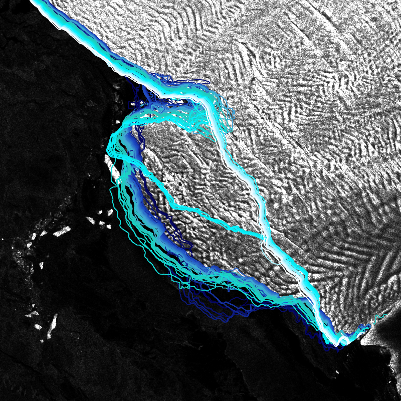
| IceLines (Ice Shelf and Glacier Front Time Series) is an automated calving front monitoring service providing monthly ice shelf front time series of major Antarctic ice shelves. The provided time series allows to discover the dynamics of ice shelf front changes and calving events. The front positions are automatically derived from Sentinel-1 data based on a deep neuronal network called HED-U-Net. The time series covers the timespan 2014 to today (partly limited due to Sentinel-1 data availability). Incorrectly extracted fronts are truncated which might lead to gaps in the time series especially between December to March due to strong surface melt. Annual averages are calculated based on the extracted monthly fronts (excluding the summer months) and provide more robust results due to temporal aggregation. | ||
 |
||
| Suggested Data Citation | ||
| German Aerospace Center (DLR) (2022): IceLines – Ice Shelf and Glacier Front Time Series, DOI: 10.15489/btc4qu75gr92 | ||
| Coverage | ||
| Yellow dots or areas indicate coverage range. | ||
| Geographic Boundaries | ||
| North: | -60° | |
| West: | -180° | |
| East: | 180° | |
| South: | -90° | |
| Time Period | ||
| Start date: | 2014-12-01 | |
| End date: | Present | |
| More Information | ||
| Keywords: | IceLines, Antarctica, Landcover, Sentinel-1, time-series, yearly, monthly, quarterly, daily, opendata | |
| Contact: | geoservice@dlr.de | |
| Access / Use Restriction: | license | |
| Data Use Guidelines | Creative Commons Attribution 4.0 International (CC BY 4.0) | |
| Links | ||
| Mission / Project Information | ||
| IceLines product information (conference poster/pdf) | https://elib.dlr.de/141526/1/2021-03-19_UKAntarcticConference-IceLines_CB.pdf Information on the IceLines product (poster/pdf) |
IceLines video | https://play.quickchannel.com/play/kjjjzyu Video showcasing the IceLines product |
| DOI: | https://doi.org/10.15489/btc4qu75gr92 Digital Object Identifier |
|
| Downloading Data | ||
| HTTP download (IceLines) | https://download.geoservice.dlr.de/icelines/files/ HTTP download |
|
| Data Visualization Service | ||
| EOC Geoservice Map Context (eoc:icelines) | https://geoservice.dlr.de/web/maps/eoc:icelines EOC Geoservice Map Context |
|
| WMS access: IceLines - Yearly | https://geoservice.dlr.de/eoc/land/wms? icelines_yearly |
|
| WMS access: IceLines - Monthly | https://geoservice.dlr.de/eoc/land/wms? icelines_monthly |
|
| WMS access: IceLines - Shelfnames | https://geoservice.dlr.de/eoc/land/wms? icelines_shelfnames |
|