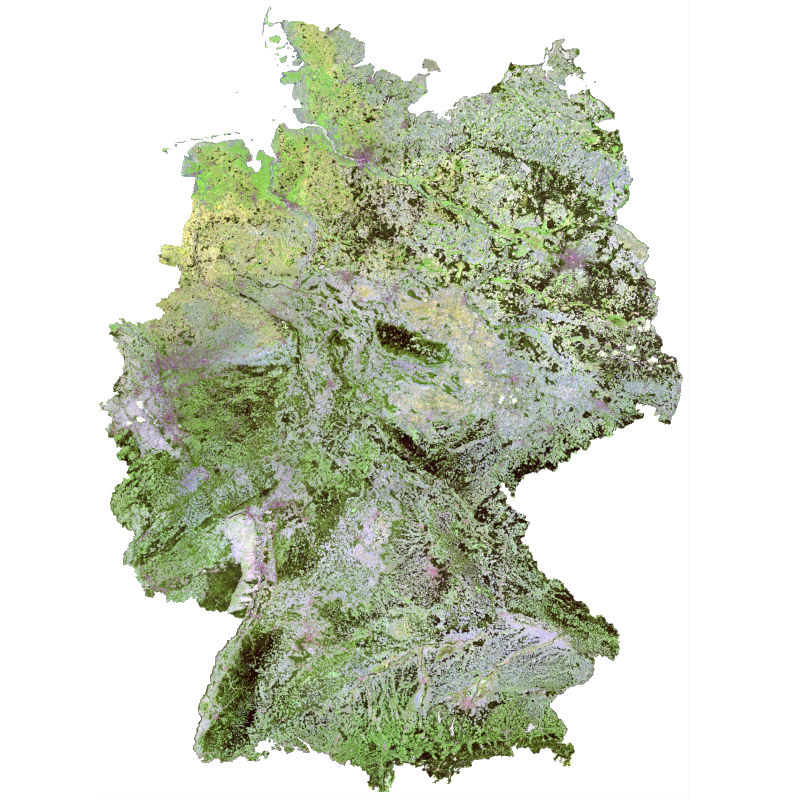
| The Soil Composite Mapping Processor (SCMaP) is a new approach designed to make use of per-pixel compositing to overcome the issue of limited soil exposure due to vegetation. Three primary product levels are generated that will allow for a long term assessment and distribution of soils that include the distribution of exposed soils, a statistical information related to soil use and intensity and the generation of exposed soil reflectance image composites. The resulting composite maps provide useful value-added information on soils with the exposed soil reflectance composites showing high spatial coverage that correlate well with existing soil maps and the underlying geological structural regions. | ||
 |
||
| Suggested Data Citation | ||
| German Aerospace Center (DLR) (2018): SCMaP - Landsat - Germany, 1984-2014. https://doi.org/10.15489/c5ng9ynnyx29 | ||
| Coverage | ||
| Yellow dots or areas indicate coverage range. | ||
| Geographic Boundaries | ||
| North: | 55° | |
| West: | 5° | |
| East: | 16° | |
| South: | 47° | |
| Time Period | ||
| Start date: | 1984-04-13 | |
| End date: | 2014-11-09 | |
| More Information | ||
| Keywords: | Soil, Landsat, Soil mapping, Image composites, automated processors, top soil analysis, time series, SCMaP, Germany | |
| Contact: | geoservice@dlr.de | |
| Access / Use Restriction: | license | |
| Data Use Guidelines | Creative Commons BY-NC-SA 4.0 | |
| Links | ||
| Mission / Project Information | ||
| OPUS-GMES Project Homepage | http://www.dlr.de/eoc/desktopdefault.aspx/tabid-9978/17061_read-41279/ OPUS-GMES |
|
| AGRO-DE Project Website | http://agro-de.info/ AGRO-DE |
|
| DOI: | https://doi.org/10.15489/c5ng9ynnyx29 Digital Object Identifier |
|
| Data Visualization Service | ||
| WMS access: SCMaP Reflectance Soil Composite (normalized) | https://geoservice.dlr.de/eoc/land/wms? SCMAP_SN_LS |
|
| WMS access: SCMaP Reflectance Soil Composite 1984-2014 (normalized) | https://geoservice.dlr.de/eoc/land/wms? SCMAP_SN_LS_1984-2014 |
|
| WMS access: SCMaP Reflectance Composite | https://geoservice.dlr.de/eoc/land/wms? SCMAP_SR_LS |
|
| WMS access: SCMaP Reflectance Composite 1984-2014 | https://geoservice.dlr.de/eoc/land/wms? SCMAP_SR_LS_1984-2014 |
|
| WMS access: SCMaP Exposed Soil Coverage | https://geoservice.dlr.de/eoc/land/wms? SCMAP_SC_LS |
|
| WMS access: SCMaP Exposed Soil Coverage 1984-2014 | https://geoservice.dlr.de/eoc/land/wms? SCMAP_SC_LS_1984-2014 |
|
| WMS access: SCMaP Exposed Soil Frequency | https://geoservice.dlr.de/eoc/land/wms? SCMAP_SF_LS |
|
| WMS access: SCMaP Exposed Soil Frequency 1984-2014 | https://geoservice.dlr.de/eoc/land/wms? SCMAP_SF_LS_1984-2014 |
|