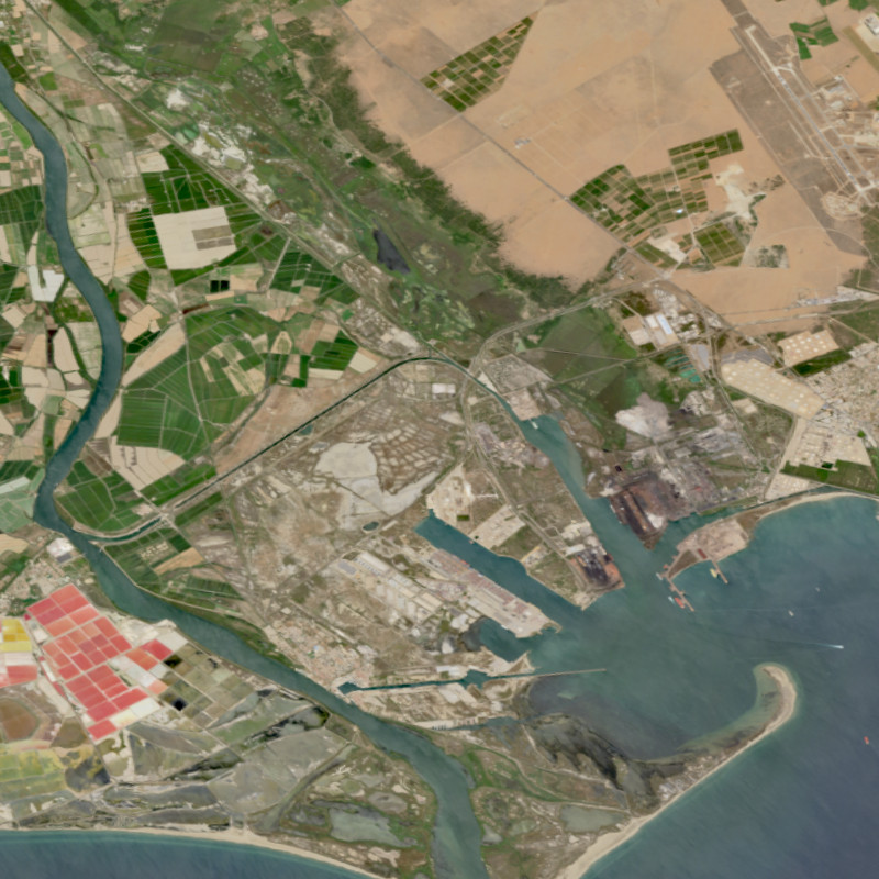
| The Environmental Mapping and Analysis Program (EnMAP) is a German hyperspectral satellite mission to monitoring and characterise Earth’s environment on a global scale. EnMAP measures and models key dynamic processes of Earth’s ecosystems by extracting geochemical, biochemical and biophysical parameters that provide information on the status and evolution of various terrestrial and aquatic ecosystems. The mission’s main objective is to study and decipher coupled environmental processes and to assist and promote the sustainable management of Earth’s resources. This collection includes Level 0 quicklook images of the mission. For more information, please see the mission website: https://www.enmap.org/ | ||
 |
||
| Suggested Data Citation | ||
| Data: EnMAP data ©DLR [year of acquisition] All rights reserved. Derivate products: Contains modified EnMAP data ©DLR [year of acquisition]. https://doi.org/10.15489/rlyibn8gjc58 | ||
| Coverage | ||
| Yellow dots or areas indicate coverage range. | ||
| Geographic Boundaries | ||
| North: | 90.00° | |
| West: | 180.00° | |
| East: | 180.00° | |
| South: | 90.00° | |
| Time Period | ||
| Start date: | 2022-04-27 | |
| End date: | Present | |
| More Information | ||
| Keywords: | DLR, EOC, EnMAP, HSI, Global, hyperspectral, quicklooks, Level 0 | |
| Contact: | ENMAP_APPLICATION_SP@dlr.de | |
| Access / Use Restriction: | Restricted - for information on data access, please see: https://www.enmap.org/data_access/ | |
| Data Use Guidelines | EnMAP Data License (pdf) | |
| Links | ||
| Mission / Project Information | ||
| Website of the EnMAP mission (html) | https://www.enmap.org/ Website of the EnMAP mission (html) |
|
| DOI: | https://doi.org/10.15489/rlyibn8gjc58 Digital Object Identifier |
|
| Product Search / Ordering | ||
| Product Catalogue (STAC): EnMAP L0 HSI Quicklook Images | https://geoservice.dlr.de/eoc/ogc/stac/v1/collections/ENMAP_HSI_L0_QL EnMAP L0 HSI Quicklook Products |
|
| EOWEB GeoPortal: EnMAP HSI L0 Products | https://geoservice.dlr.de/egp/main?ecswCollection=urn%3Aeop%3ADLR%3AEOWEB%3AENMAP.HSI.L0 EnMAP L0 HSI Products |
|
| Downloading Data | ||
| HTTP download (EnMAP HSI Quicklook Images) | https://download.geoservice.dlr.de/ENMAP/files/ HTTP download |
|
| Data Visualization Service | ||
| EOC Geoservice Map Context (enmap:l0) | https://geoservice.dlr.de/web/maps/enmap:l0 EOC Geoservice Map Context |
|
| WMS access: EnMAP HSI L0 Quicklooks VNIR | https://geoservice.dlr.de/eoc/imagery/wms? ENMAP_HSI_L0_QL_VNIR |
|
| WMS access: EnMAP HSI L0 Quicklooks SWIR | https://geoservice.dlr.de/eoc/imagery/wms? ENMAP_HSI_L0_QL_SWIR |
|
| WMS access: EnMAP HSI L0 Quicklooks Quality Snow | https://geoservice.dlr.de/eoc/imagery/wms? ENMAP_HSI_L0_QL_QUALITY_SNOW |
|
| WMS access: EnMAP HSI L0 Quicklooks Quality Haze | https://geoservice.dlr.de/eoc/imagery/wms? ENMAP_HSI_L0_QL_QUALITY_HAZE |
|
| WMS access: EnMAP HSI L0 Quicklooks Quality Cloudshadow | https://geoservice.dlr.de/eoc/imagery/wms? ENMAP_HSI_L0_QL_QUALITY_CLOUDSHADOW |
|
| WMS access: EnMAP HSI L0 Quicklooks Quality Cloud | https://geoservice.dlr.de/eoc/imagery/wms? ENMAP_HSI_L0_QL_QUALITY_CLOUD |
|
| WMS access: EnMAP HSI L0 Quicklooks Quality Classes | https://geoservice.dlr.de/eoc/imagery/wms? ENMAP_HSI_L0_QL_QUALITY_CLASSES |
|
| WMS access: EnMAP HSI L0 Quicklooks Quality Cirrus | https://geoservice.dlr.de/eoc/imagery/wms? ENMAP_HSI_L0_QL_QUALITY_CIRRUS |
|