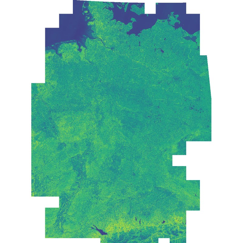
| This dataset includes the normalized difference vegetation index (NDVI) derived from Sentinel-2 imagery. Using the Google Earth Engine, all granules with a cloud cover below 60% were used as input. Cloudy pixels (referring to quality layer QA60) were masked as well. Eventually, a median mosaic was composed over the whole observation period. It was also used as input for a land cover classification (see: Land Cover DE - Sentinel-2 - Germany, 2015). | ||
 |
||
| Suggested Data Citation | ||
| German Aerospace Center (DLR) (2023): Sentinel-2 - Vegetation Index (NDVI) - Germany, 2015. https://doi.org/10.15489/z5rq0pr8wv85 | ||
| Coverage | ||
| Geographic Boundaries | ||
| North: | 55.03° | |
| West: | 5.39° | |
| East: | 15.57° | |
| South: | 47.12° | |
| Time Period | ||
| Start date: | 2015-06-27 | |
| End date: | 2017-09-29 | |
| More Information | ||
| Keywords: | Sentinel-2, Land Cover, Vegetation, Greenness, Health, Urban Heat Islands, Germany, opendata | |
| Contact: | geoservice@dlr.de | |
| Access / Use Restriction: | License | |
| Data Use Guidelines | Creative Commons BY-NC 4.0 | |
| Links | ||
| Mission / Project Information | ||
| Project Website | https://www.dlr.de/de/eoc/forschung-transfer/projekte-und-missionen/noise2nako-ai Noise2NAKO(AI) project website |
|
| DOI (of Dataset) | https://doi.org/10.15489/z5rq0pr8wv85 Digital Object Identifier |
|
| Land Cover DE | https://geoservice.dlr.de/web/maps/de:lcc Geoservie Map Context (de:lcc) |
|
| Downloading Data | ||
| HTTP Download (Noise2NAKO NDVI) | https://download.geoservice.dlr.de/NOISE2NAKO/files/NDVI/ HTTP Download |
|