ENMAP01-_____L0-DT0000171947_20251224T153845Z_007_V010505_20251225T005105Z json
Collection:
- Platform: EnMAP
- Serial: 01
- Instrument: HSI
- Composite Type: P1D
- Sensor Type: OPTICAL
Extents:
- Spatial: -70.7167, -15.1246, -70.3671, -14.8139
- Temporal: 2025-12-24T15:39:12.666Z / 2025-12-24T15:39:17.201Z
Map:
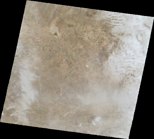
Preview:
Properties:
- Parent Identifier: ENMAP_HSI_L0_QL
- Crs: EPSG:4326
- Created: Dec 26, 2025, 7:44:54 PM
- Updated: Dec 26, 2025, 7:44:54 PM
- Cloud Cover: 40
- Snow Cover: 0
- Platform: EnMAP
- Platform Serial Identifier: 01
- Tile Id: 07
- Processing Center: NZ
- Processing Level: 0
- Processing Date: Dec 25, 2025, 12:51:05 AM
- Product Version: 01.05.05
- Orbit Direction: DESCENDING
- Orbit Number: 20091
- Swath Identifier: 0000171947
- [ENMAP] Cirrus Cover: 50
- [ENMAP] Cloud Shadow: 0
- [ENMAP] Datatakeid: 0000171947
- [ENMAP] Haze Cover: 0
- [ENMAP] Noncloud Shadow: 0
- [ENMAP] Water Cover: 0
Assets:
Properties: Download
- Key: THUMBNAIL
- Title: Thumbnail
- Type: image/png
- Roles: thumbnail
- Description: Thumbnail derived from VNIR
- Link: https://download.geoservice.dlr.de/ENMAP/files/L0/2025/12/24/ENMAP01-_____L0-DT0000171947_20251224T153845Z_007_V010505_20251225T005105Z-QL_VNIR_THUMBNAIL.png
Properties: Download
- Key: OVERVIEW
- Title: Overview
- Type: image/png
- Roles: overview
- Description: Overview derived from VNIR
- Link: https://download.geoservice.dlr.de/ENMAP/files/L0/2025/12/24/ENMAP01-_____L0-DT0000171947_20251224T153845Z_007_V010505_20251225T005105Z-QL_VNIR_OVERVIEW.png
Properties: Download
- Key: VNIR
- Title: VNIR
- Type: image/tiff; application=geotiff; profile=cloud-optimized
- Roles: visual
- Description: description
- Link: https://download.geoservice.dlr.de/ENMAP/files/L0/2025/12/24/ENMAP01-_____L0-DT0000171947_20251224T153845Z_007_V010505_20251225T005105Z-QL_VNIR_COG.TIF
Properties: Download
- Key: SWIR
- Title: SWIR
- Type: image/tiff; application=geotiff; profile=cloud-optimized
- Roles: visual
- Description: description
- Link: https://download.geoservice.dlr.de/ENMAP/files/L0/2025/12/24/ENMAP01-_____L0-DT0000171947_20251224T153845Z_007_V010505_20251225T005105Z-QL_SWIR_COG.TIF
Properties: Download
- Key: QUALITY_CLOUD
- Title: QUALITY_CLOUD
- Type: image/tiff; application=geotiff; profile=cloud-optimized
- Roles: quality
- Description: description
- Link: https://download.geoservice.dlr.de/ENMAP/files/L0/2025/12/24/ENMAP01-_____L0-DT0000171947_20251224T153845Z_007_V010505_20251225T005105Z-QL_QUALITY_CLOUD_COG.TIF
Properties: Download
- Key: QUALITY_CLOUDSHADOW
- Title: QUALITY_CLOUDSHADOW
- Type: image/tiff; application=geotiff; profile=cloud-optimized
- Roles: quality
- Description: description
- Link: https://download.geoservice.dlr.de/ENMAP/files/L0/2025/12/24/ENMAP01-_____L0-DT0000171947_20251224T153845Z_007_V010505_20251225T005105Z-QL_QUALITY_CLOUDSHADOW_COG.TIF
Properties: Download
- Key: QUALITY_CIRRUS
- Title: QUALITY_CIRRUS
- Type: image/tiff; application=geotiff; profile=cloud-optimized
- Roles: quality
- Description: description
- Link: https://download.geoservice.dlr.de/ENMAP/files/L0/2025/12/24/ENMAP01-_____L0-DT0000171947_20251224T153845Z_007_V010505_20251225T005105Z-QL_QUALITY_CIRRUS_COG.TIF
Properties: Download
- Key: QUALITY_CLASSES
- Title: QUALITY_CLASSES
- Type: image/tiff; application=geotiff; profile=cloud-optimized
- Roles: quality
- Description: description
- Link: https://download.geoservice.dlr.de/ENMAP/files/L0/2025/12/24/ENMAP01-_____L0-DT0000171947_20251224T153845Z_007_V010505_20251225T005105Z-QL_QUALITY_CLASSES_COG.TIF
Properties: Download
- Key: QUALITY_SNOW
- Title: QUALITY_SNOW
- Type: image/tiff; application=geotiff; profile=cloud-optimized
- Roles: quality
- Description: description
- Link: https://download.geoservice.dlr.de/ENMAP/files/L0/2025/12/24/ENMAP01-_____L0-DT0000171947_20251224T153845Z_007_V010505_20251225T005105Z-QL_QUALITY_SNOW_COG.TIF
Properties: Download
- Key: QUALITY_HAZE
- Title: QUALITY_HAZE
- Type: image/tiff; application=geotiff; profile=cloud-optimized
- Roles: quality
- Description: description
- Link: https://download.geoservice.dlr.de/ENMAP/files/L0/2025/12/24/ENMAP01-_____L0-DT0000171947_20251224T153845Z_007_V010505_20251225T005105Z-QL_QUALITY_HAZE_COG.TIF
Properties: Download
- Key: PIXELMASK_VNIR
- Title: PIXELMASK_VNIR
- Type: image/tiff;
- Roles: quality
- Description: description
- Link: https://download.geoservice.dlr.de/ENMAP/files/L0/2025/12/24/ENMAP01-_____L0-DT0000171947_20251224T153845Z_007_V010505_20251225T005105Z-QL_PIXELMASK_VNIR.TIF
Properties: Download
- Key: PIXELMASK_SWIR
- Title: PIXELMASK_SWIR
- Type: image/tiff;
- Roles: quality
- Description: description
- Link: https://download.geoservice.dlr.de/ENMAP/files/L0/2025/12/24/ENMAP01-_____L0-DT0000171947_20251224T153845Z_007_V010505_20251225T005105Z-QL_PIXELMASK_SWIR.TIF
Properties: Download
- Key: TESTFLAGS_SWIR
- Title: TESTFLAGS_SWIR
- Type: image/tiff;
- Roles: quality
- Description: description
- Link: https://download.geoservice.dlr.de/ENMAP/files/L0/2025/12/24/ENMAP01-_____L0-DT0000171947_20251224T153845Z_007_V010505_20251225T005105Z-QL_QUALITY_TESTFLAGS_SWIR.TIF
Properties: Download
- Key: TESTFLAGS_VNIR
- Title: TESTFLAGS_VNIR
- Type: image/tiff;
- Roles: quality
- Description: description
- Link: https://download.geoservice.dlr.de/ENMAP/files/L0/2025/12/24/ENMAP01-_____L0-DT0000171947_20251224T153845Z_007_V010505_20251225T005105Z-QL_QUALITY_TESTFLAGS_VNIR.TIF
Services:
- WMS GetCapabilities
- WMS GetMap VNIR (image/jpeg)
- WMS GetMap SWIR (image/jpeg)
- WMS GetMap Classes (image/jpeg)
- WMS GetMap Cirrus (image/jpeg)
- WMS GetMap Cloud (image/jpeg)
- WMS GetMap Cloudshadow (image/jpeg)
- WMS GetMap Haze (image/jpeg)
- WMS GetMap Snow (image/jpeg)
- WCS GetCapabilities
- WCS DescribeCoverage VNIR
- WCS DescribeCoverage SWIR
- WCS GetCoverage VNIR
- WCS GetCoverage SWIR