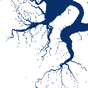
Surface Water Inventory and Monitoring (SWIM) Water Extent items
Properties:
- Name: SWIM_WE
- Title: Surface Water Inventory and Monitoring (SWIM) Water Extent
- Description: SWIM-WE provides open surface water bodies as identified by an automated processing chain. The water segmentation is derived with sensor-specific pre-trained deep neural networks from high-resolution Sentinel-1 and Sentinel-2 satellite images.
- License: CC-BY-NC-4.0
- Composite Type: P1D
- Security constraints: No Publications:
- Bereczky, M., Wieland, M., Krullikowski, C., Martinis, S., & Plank, S. (2022). Sentinel-1-based water and flood mapping: Benchmarking convolutional neural networks against an operational rule-based processing chain. IEEE Journal of Selected Topics in Applied Earth Observations and Remote Sensing, 15, 2023-2036., 10.1109/JSTARS.2022.3152127
- Wieland, M., & Martinis, S. (2019). A modular processing chain for automated flood monitoring from multi-spectral satellite data. Remote Sensing, 11(19), 2330., 10.3390/rs11192330
Extents:
- Spatial: -180, -90, 180, 90
- Temporal: 2024-01-01T00:00:00Z /
