TDM_FNF_20_S28E120 json
Collection:
- Platform: TanDEM-X / TerraSAR-X
- Serial: TDX-1 / TSX-1
- Instrument: InSAR
- Sensor Type: RADAR
Extents:
- Spatial: 119.9998, -28.0002, 121.0003, -26.9997
- Temporal: 2011-01-01T00:00:00Z / 2015-12-31T00:00:00Z
Map:
Preview:
Properties:
- Parent Identifier: TDM_FNF_50
- Crs: 4326
- Created: Jul 27, 2023, 4:22:26 PM
- Updated: Sep 22, 2023, 2:50:31 PM
- [PROJ] Epsg: 4326
- [TDM] Tile Lat: S28
- [TDM] Tile Long: E120
Assets:
Properties: Download
- Key: thumbnail
- Title: Thumbnail
- Type: image/png
- Roles: thumbnail
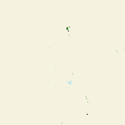
- Description: Thumbnail generated from the TanDEM-X Forest/Non-Forest (FNF) Asset with a size of 512x512.
- Link: https://download.geoservice.dlr.de/FNF50/files/S28/E120/TDM_FNF_20_S28E120/TDM_FNF_20_S28E120_cog_thumbnail.png
Properties: Download
- Key: overview
- Title: Overview
- Type: image/tiff; application=geotiff; profile=cloud-optimized
- Roles: overview
- Description: Overview generated from the TanDEM-X Forest/Non-Forest (FNF) Asset as Cloud-Optimized GeoTIFF.
- Link: https://download.geoservice.dlr.de/FNF50/files/S28/E120/TDM_FNF_20_S28E120/TDM_FNF_20_S28E120_cog_overview.tif
Properties: Download
- Key: fnf
- Title: TanDEM-X Forest/Non-Forest (FNF)
- Type: image/tiff; application=geotiff; profile=cloud-optimized
- Roles: data
- Description: TanDEM-X global Forest/Non-Forest Map. 0: for invalid pixels and urban areas. 1: for forested areas. 2: for non-forested areas. 3: for water bodies.
- Link: https://download.geoservice.dlr.de/FNF50/files/S28/E120/TDM_FNF_20_S28E120/TDM_FNF_20_S28E120_cog.tif
Raster Bands:
- Data Type: uint8
- Scale: 1
- Offset: 0
- Sampling: area
- Nodata: 0
- Statistics:
- Mean: 2
- Minimum: 1
- Maximum: 3
- Stddev: 0.0302
- Valid Percent: 99.9556
- Histogram:
- Count: 11
- Min: 1
- Max: 3
- Buckets: 501
Properties: Download
- Key: zip
- Title: TanDEM-X FNF all files (ZIP)
- Type: application/x-zip
- Roles: data
- Description: The orignal FNF ZIP folder.
- Link: https://download.geoservice.dlr.de/FNF50/files/S28/E120/TDM_FNF_20_S28E120/TDM_FNF_20_S28E120.zip
Properties: Download
- Key: fnfcov
- Title: TanDEM-X FNF COVerage map (COV)
- Type: image/tiff; application=geotiff; profile=cloud-optimized
- Roles: data
- Description: Number of TanDEM-X scenes used to generate FNF Map. The values in the coverage map refer to the number of mosaicked acquisitions for each pixel and range from 0 and 10. 0 indicates no acquisition coverage. 10 represents 10 or more mosaicked acquisitions.
- Link: https://download.geoservice.dlr.de/FNF50/files/S28/E120/TDM_FNF_20_S28E120/TDM_FNF_20_S28E120_COV_cog.tif
Raster Bands:
- Data Type: uint8
- Scale: 1
- Offset: 0
- Sampling: area
- Nodata: 0
- Statistics:
- Mean: 2.3444
- Minimum: 1
- Maximum: 4
- Stddev: 0.5129
- Valid Percent: 99.9962
- Histogram:
- Count: 11
- Min: 1
- Max: 4
- Buckets: 284
Properties: Download
- Key: fnfspc
- Title: TanDEM-X FNF Super Pixels Count (SPC)
- Type: image/tiff; application=geotiff; profile=cloud-optimized
- Roles: data
- Description: The global FNF super pixels count map. The values in the super pixel count map range from 0 to 10. 0 indicates no super pixel. 10 represents 10 or more detected super pixels.
- Link: https://download.geoservice.dlr.de/FNF50/files/S28/E120/TDM_FNF_20_S28E120/TDM_FNF_20_S28E120_SPC_cog.tif
Raster Bands:
- Data Type: uint8
- Scale: 1
- Offset: 0
- Sampling: area
- Nodata: 0
- Statistics:
- Mean: 1.7239
- Minimum: 1
- Maximum: 4
- Stddev: 0.5704
- Valid Percent: 87.6616
- Histogram:
- Count: 11
- Min: 1
- Max: 4
- Buckets: 310112
Properties: Download
- Key: fnfspd
- Title: TanDEM-X FNF Super Pixels Date (SPD)
- Type: image/tiff; application=geotiff; profile=cloud-optimized
- Roles: data
- Description: The global FNF super pixels date map. The values in the super pixel date map refer to the date of last occurrence of a super pixel. The dates refer to year and month.
- Link: https://download.geoservice.dlr.de/FNF50/files/S28/E120/TDM_FNF_20_S28E120/TDM_FNF_20_S28E120_SPD_cog.tif
Raster Bands:
- Data Type: uint8
- Scale: 1
- Offset: 0
- Sampling: area
- Nodata: 0
- Statistics:
- Mean: 47.7367
- Minimum: 22
- Maximum: 64
- Stddev: 10.9548
- Valid Percent: 88.7268
- Histogram:
- Count: 11
- Min: 22
- Max: 64
- Buckets: 72065