Skip navigation

Release of the World Settlement Footprint 3D Data Sets

Posted on Feb 15, 2023 by Administrator

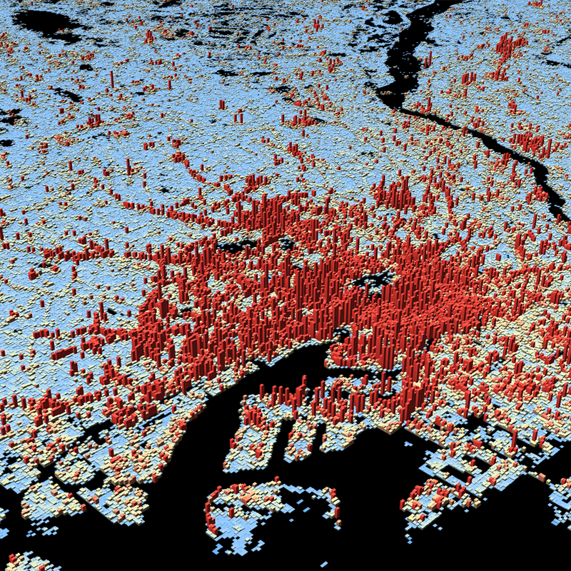
The World Settlement Footprint (WSF) 3D datasets provide detailed quantification of the average height, total volume, total area and the fraction of buildings at 90 m resolution at a global scale. It is generated using a modified version of the World Settlement Footprint human settlements mask derived from Sentinel-1 and Sentinel-2 satellite imagery in combination with digital elevation data and radar imagery collected by the TanDEM-X mission. [1]. In addition to the 2D view in the WMS, the data is also accessible to the user in a 3D view. It is a derivative of the WSF3D raster dataset tailored for the web. As a tiled vector dataset, it enables dynamic client-side visualization of the WSF3D metrics. The WSF 3D datasets can be explored via EOC GeoService Webapp [2], via the 3D Viewer [3] or can be downloaded directly from the EOC Download Service [4].

Release of the IceLines Data Set

Posted on Sep 14, 2022 by Administrator

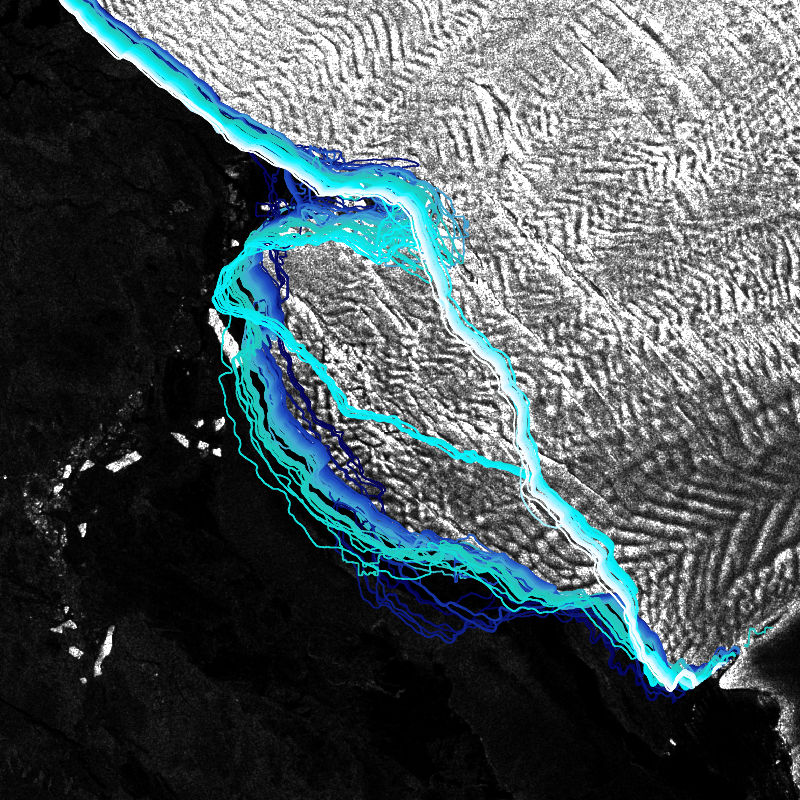
The IceLines dataset provides information on Antarctic ice shelf front dynamics. This allows conclusions on iceberg calving mechanisms and to observe changes in the Antarctic coastline. On the basis of Sentinel-1 data, the fronts of the largest ice shelves of Antarctica are continuously mapped with a deep learning approach (HED-Unet) [1] [2]. The generated dataset includes front positions for 36 ice shelves with a daily, monthly, seasonal and annual temporal resolution since the launch of Sentinel-1 in 2014. IceLines is updated on a monthly basis and can be explored via the EOC GeoService Webapp [3] or directly downloaded from the EOC Download Service [4]. Further information on the product is available on a separate DLR website [5].

Release of the Tree Canopy Cover Loss Map for Germany

Posted on Aug 9, 2022 by Administrator

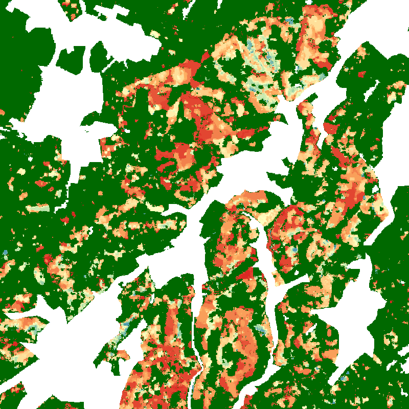
The product shows monthly tree canopy cover loss information between January 2018 and April 2021 for Germany. The dataset is based on image composites of the disturbance index (DI) derived from Sentinel-2 and Landsat-8 time series. In addition, different maps of tree canopy cover loss in Germany per district (Landkreis) are available depicting the losses for different forest types in absolute numbers and in percentages.

The datasets are now available in the EOC Geoservice Webapp [1] and can also be downloaded from the EOC Download Service [2]. Further information on the product is available on the DLR news website [3].

Release of the UrMo Digital Traffic Area Map for Braunschweig, Germany

Posted on Aug 1, 2022 by Administrator

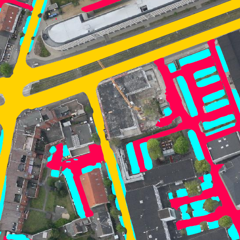
The Traffic Area Map is a dataset providing information about the inventory of different traffic areas for the city of Brunswick, Germany. The map is based on aerial image sequences acquired with the DLR 3K camera system during six flight campaigns at different times of the day and year in 2019 and 2020.

The dataset is now available in the EOC Geoservice Webapp [1] and can also be downloaded from the EOC Download Service [2]. Further information on the UrMo Digital project is available on a separate DLR website [3].

Release of the Global SnowPack (GSP)

Posted on Apr 29, 2022 by Administrator

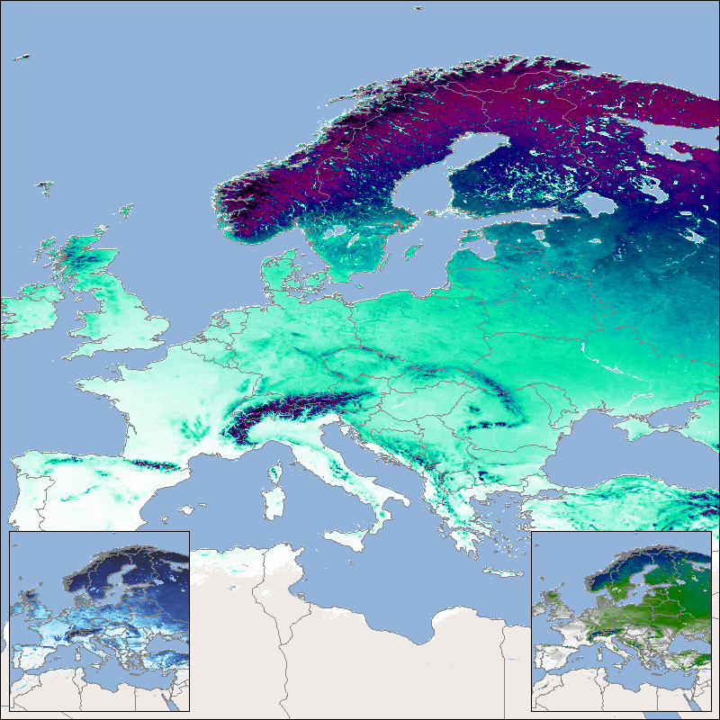
The new version of the Global SnowPack displays snow parameters like duration and extent globally. The yearly products show the snow cover duration for the entire hydrological year, early snow cover duration and the late snow cover duration. [1]. The daily products show the snow cover extent, which is processed in near real time [2]. Additionally, the GSP mean has been released, which is updated each year and consists of the arithmetic mean for the entire time series [3].

The datasets is now available in the EOC Geoservice Webapp and can also be downloaded from the EOC Download Service [4]. Further information on the product is available on a separate DLR website [5].

EOC Download Service: Map search interface for Sentinel-2 L2A MAJA data

Posted on Dec 10, 2021 by Administrator

A new map-based search interface for atmosphere-corrected (MAJA) Sentinel-2 data over Germany now facilitates the selection of scenes for download. New features like a time slider and easy to handle view options for quicklooks bring additional comfort while browsing for images. The new map interface can be accessed within the EOC Download Service [1]. In addition, the interface prior in place, which allowed to browse for scenes through a structure of folders remains available too [2].
The MAJA atmospheric-correction processor, developed by DLR in cooperation with CNES, calculates "Bottom of Atmosphere" reflectance for Sentinel-2 images based on image stack analysis. Further information on this dataset is available at this site [3].

Release of the World Settlement Footprint (WSF) 2019 and Evolution

Posted on Nov 15, 2021 by Administrator

The World Settlement Footprint (WSF) 2019 and Evolution are global maps of human settlements which have been generated by means of an advanced classification technique that jointly exploits multi decadal open and free optical and radar imagery. While the World Settlement Footprint (WSF) 2019 is a 10m resolution binary mask outlining the extent of human settlements globally derived by means of 2019 multitemporal Sentinel-1 and Sentinel-2 imagery, the World Settlement Footprint Evolution depicts the global settlement extent on a yearly basis from 1985 to 2015 at a spatial resolution of 30 meters. The dataset can be visualized in the EOC Geoservice Webapp [1] [2] and can also be downloaded from the EOC Download Service [3] [4].

Release of the TanDEM-X PolarDEM 90m of Antarctica

Posted on Dec 11, 2020 by Administrator

The TanDEM-X PolarDEM 90m of Antarctica is a gap-free digital elevation model (DEM) product of Antarctica generated from the TanDEM-X mission in 90 meter resolution. The DEM product was derived from the global TanDEM-X DEM undergoing a gap-filling process with additional TanDEM-X acquisitions and an editing especially of noisy ocean values. The DEM represents elevation values mainly from data acquired in 2013 and 2014. The TanDEM-X PolarDEM is a project developed by the German Remote Sensing Data Center (DFD) at the German Aerospace Center (DLR) within the activities of the TanDEM-X mission. It is a framework for the provision of derivatives of the global Digital Elevation Model (DEM) of the TanDEM-X mission for Polar Regions [1]. The dataset can be visualized in the EOC Geoservice Webapp [2] and after registration, also be downloaded from the EOC Download Service [3].

Release of TimeScan Landsat data

Posted on Nov 4, 2020 by Administrator

The TimeScan Landsat 2015 layer [1, 2] is a higher-processing level baseline product providing a harmonized representation of the spectral and temporal properties of the land surface. The global TimeScan Landsat 2015 dataset was derived from over 450,000 Landsat-8 images (~500TB) collected from 2013 to 2015. The product condenses the information content of the original images to a 20th of their original size. The TimeScan Landsat 2015 layer can be analyzed in the form of a single, global, cloud-free dataset based on statistical ranges of 6 indices for such aspects as the state of vegetation, water cover, or human settlement (built-up areas). For each of the recorded indices the statistics provide the minimal, maximal and mean values along with the standard deviation and the mean slope determined for the entire period from 2013 to 2015. The TimeScan procedure is designed to help end users exploit information from masses of data that until now were too unwieldy for them to handle.

Release of MetOp-C GOME-2 data

Posted on May 27, 2020 by Administrator

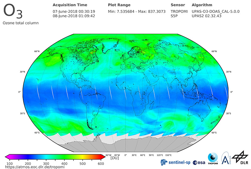
The EOC Geoservice map context "MetOp GOME-2 Daily Total Column Composites" [1] shows composites calculated from daily products of different trace gases and cloud properties measured by the "Global Ozone Monitoring Experiment-2" (GOME-2) instruments onboard EUMETSAT's MetOp satellite series. The products data stream has now been accomplished by EUMETSAT's MetOp-C satellite unit which was launched in November 2018 and secures the future data flow at least until the year 2025. Please see the according news release [2] for further information.

In addition to the introduction of MetOp-C, the following changes have been performed to the MetOp GOME-2 WMS/WCS services:

  • The publication of MetOp-A maps in the Geoservice ended on 2020-04-07 and is superseded by MetOp-C.
  • The publication of MetOp-AB maps (combined composite products of MetOp-A and MetOp-B) ended on 2020-04-07 and is superseded by combined products using data from MetOp-B and MetOp-C. The existing older MetOp-AB and new MetOp-BC products are now available in a new "Combined" map layer as a continuous time-series.
  • NRT-products are no longer available as separate "LATEST/PREVIOUS"-layers, but are now included in the regular layers of the Daily ("P1D") products.

The new layer names and titles are defined using the following schema:

MetOp-B/C GOME-2:
Layer Name: METOP-[B/C]_GOME-2_L2C_P1D_[PARAMETER]
Layer Title: MetOp-[B/C] GOME-2 L2C Daily [PARAMETER]

MetOp GOME-2 Combined:
Layer Name: METOP_GOME-2_L2C_P1D_COMB_[PARAMETER]
Layer Title: MetOp GOME-2 L2C Daily [PARAMETER] Combined

The collections can be visualized in the EOC Geoservice Webapp [1] and accessed via OGC web services [3] [4].