Skip navigation

Introduction

TanDEM-X (TerraSAR-X add-on for Digital Elevation Measurements) is an Earth observation radar mission that consists of a SAR interferometer built by two almost identical satellites flying in close formation. Cross-track interferometry with typical separations between the satellites of 120m to 500m enables the acquisition of accurate interferograms not impacted by temporal decorrelation and atmospheric disturbances. The primary objective of the mission – the generation of a global Digital Elevation Model (DEM) – was achieved in 2016. The absolute height error is with about 1m an order of magnitude below the 10m specification.

While working on the global DEM, it became clear that Earth’s surface is highly dynamic – changes in the height of glaciers, permafrost areas and forests were to be expected, but changes due to agricultural activities and infrastructure projects also leave clear traces and can be measured. Therefore, in 2017 the decision was made to continue the mission with a focus on topographical changes. To provide easy access to these changes, the following products have been created and are now available.

The TanDEM-X 30m Edited Digital Elevation Model (EDEM) offered here for download is an edited version of the TanDEM-X Global DEM with a 1 arcsec pixel spacing, which corresponds to approximately 30m at the equator. It covers with 150 Mio sqkm all Earth’s landmasses from pole to pole and serves as reference for topographical changes.

The TanDEM-X 30m DEM Change Maps (DCM) are also generated with a 1 arcsec pixel spacing and provide the DEM changes with respect to the EDEM reference for new data acquired since 2016. Since these new data are calibrated over stable areas against the TanDEM-X 30m EDEM, their absolute height accuracy is also in the order of 1m. DCMs are annotated with precise time stamps on a pixel basis to enable multitemporal analyses.

Please check the references [R01], [R02], [R03] in the literature chapter for further details on the TanDEM-X 30m Edited DEM, and [R04], [R05] for further details on the TanDEM-X 30m DEM Change Maps.

Applications

  • Earth sciences (geology, glaciology, oceanography, meteorology, hydrology)
  • Environmental research, land use, vegetation monitoring, urban and infrastructure planning
  • Cartography, navigation, logistics, crisis management, defence and security

Some Numbers:

Product Number of Products Size of the global data set, zipped (including all annotations) Size of the global data set, unzipped (including all annotations) Size of the global data set, unzipped (main raster files only)
EDEM 19389 2.8 TB  5.6 TB 1.6 TB
DCM 19389 x 2 5.2 TB 10.4 TB 1.3 TB


This information page gives an overview about the basic products specifications of the TanDEM-X 30m Edited DEM and the TanDEM-X 30m DEM Change Maps product, explains how to register, and how to download the TanDEM-X 30m EDEM and DCM data sets, which license terms for the use of the data have to be considered, and comprises basic compatibility issues, which might arise when other global or local height data sets are planned to be compared or to be combined with the TanDEM-X 30m products. At the end of this page suggestions for further readings and literature, a FAQ, tips for software tools, and contact information can be found.

Overview of the TanDEM-X 30m Edited DEM Product Description

The TanDEM-X 30 EDEM product offered for download is based on the TanDEM-X DEM product in 1 arcsec, whose specification document can be found here:

TanDEM-X DEM Product Specification


The product description of the TanDEM-X 30m EDEM product can be downloaded here:

TanDEM-X 30m Edited DEM Product Description

The main component of the TanDEM-X 30m Edited DEM is an edited version of the 1 arcsec product variant of the TanDEM-X Global DEM product in Version 1.0. As such it has the following basic characteristics:

  • The TanDEM-X DEM represents a Digital Surface Model (DSM), means it does not represent the bare earth surface, when e.g. vegetation or man-made objects are present.
  • The current release is an edited version, which means:
    • that gaps (voids) in the data have been interpolated or in case of larger extend filled with suitable alternative DEM data
    • that water bodies (rivers, lakes, ocean) have been flattened
  • The WGS84 horizontal datum is maintained from the unedited version and described by EPSG: 4326.
  • The EDEM product is written in two vertical coordinates systems:
    • WGS84 Ellipsoid, described by EPSG: 4979
    • EGM2008 Geoid, described by EPSG: 3855


DEM Accuracy

The global accuracy goals for the TanDEM-X 12m (0.4 arcsec) DEM products have been defined as follows:

  • The Absolute horizontal accuracy, expressed as a circular error at 90% confidence level (CE90): below 10m
  • The Absolute vertical accuracy expressed as a linear error at 90% confidence level (LE90): below 10m
  • The Relative vertical accuracy expressed as linear errors at 90% confidence level (LE90) for slopes at or below 20% at 2m, and for slopes above 20% at 4m.

Validation results (see [R06] and [R07] in the literature chapter) have shown, that the performance goal for the 12m DEM have been reached, and that the absolute vertical error and the relative vertical error are both well below the specified performance goal. Due to spatial averaging will the relative vertical error of the TanDEM-X 30m EDEM (1arcsec) product be much better than the relative vertical error of the TanDEM-X 12m (0.4 arcsec) product. The quality of the edited areas depends strongly on the used references, and the complexity of the waterbodies.


Product File Structure

The TanDEM-X 30m Edited DEM product is delivered in a compressed ZIP (*zip) format. Each zip file contains a main folder, which contains basically the meta data of the product in XML (*.xml) format. In the main folder there are 4 subfolders:

  1. EDEM: Two DEM raster layer with 2 different vertical height systems
    • Ellipsoidal height (WGS84)
    • Geoid Height (EGM2008)
  2. EDEM_AUXFILES: The 3 information raster layer:
    • Editing Mask (EDM): Marks the areas which have been edited/annotated, color-coded (8bit)
    • Height Error Mask (HEM): The estimated height error from the unedited DEM (16bit float)
    • Land Cover Mask (LCM): The main land cover classes (forest, land and water), color-coded (8bit)
  3. EDEM_PREVIEW: Hill Shade Display (HSD), quicklooks with legend and one KMZ file with the EDM as overlay.
  4. EDEM_SUPPORT: The XML Schema Definition files


The 2 DEM files as well as the layers are in a GeoTIFF (*.tif) raster format, but with different bit depths. Finally, the meta data file includes various parameters, which were used to generate the product, as well as statistics for the DEM and the editing.


Naming Convention

The file naming convention of the TanDEM-X 30m Edited DEM geocells refers to the latitude and longitude value of the lower left or southwest corner pixel of a product. The prefix string in the file base name has the general form:
”TDM1_tttt_nn_BbbXxxx” (e.g. TDM1_EDEM_10_N22E040.zip).
The main tif files have a sufix with the general form:
”TDM1_tttt_nn_BbbXxxx_FFFF_CCC.tif” (e.g. TDM1_EDEM_10_N22E040_EDEM_W84.tif)
and the tif Auxfiles as well as preview:
”TDM1_tttt_nn_BbbXxxx_FFF.tif” (e.g. TDM1_EDEM_10_N22E040_EDM.tif)
The meaning of the letter codes is given in following table.

Letter Meaning Example
tttt Product type, i.e. EDEM EDEM
nn Spacing, 10: original spacing, 1 arcsec grid 10
10 (1 arcsec, 30m at equator)
B “N” if the center of southwest corner pixel of a tile is on the Equator or north of it. “S” if it is south of the Equator N
bb 2-digit latitude value of the center of the southwest corner pixel of a tile in degrees 22
X “E” if the center of the southwest corner pixel of a tile is in the eastern hemisphere, “W” otherwise. If the center of the southwest pixel of the tile is exactly at 0° longitude, this is “E”. If the center of the southwest corner pixel is exactly at ±180° longitude, this is “W”. W
xxx 3-digit longitude value of the center of the southwest corner of a tile in degrees. 040
FFFF
FFF

FFF
Layer type
Auxiliary files types are:
  EDM (editing mask)
  LCM (land cover map)
Preview
  HSD (hillshade display)
EDEM
CCC Used vertical datum for the main product W84


placeholder-content (important)

Background Value of the HEM Layer

Pixel position whose height values has been edited receive the background value –32767.0 in the HEM.


Product Tile Extent

All 30m EDEM and DCM products between 0° - 60° North/South latitude have a file extent of 1° in latitude direction and 1° in longitude direction. Between 60° - 80° North/South latitudes a product has an extent of 1° x 2°, between 80° - 90° North/South latitudes a product tile has an extent of 1° x 4°.


Pixel Spacing

The pixel spacing for the TanDEM-X 30m EDEM and the DCM product in latitude direction towards the poles is constant at 1 arcsec, but the pixel spacing in longitudinal directions is not. Instead 6 different zones with different longitudinal pixel spacing ranging from 1 arcsec to 10 arcsec are defined for both the Northern and Southern hemisphere. In a metric scale the latitude pixel spacing varies only slightly due to the ellipsoid flattening between 30.92m at the equator and 30.82m at the pole (rounded to 31m in the table below), while for the longitudinal pixel spacing larger differences are present.


TanDEM-X 90m DEM Latitude Zones


Zone
Latitude Zone Extension
Latitude Pixel Spacing [arsec]
Longitude Pixel Spacing [arsec]
V80° - 85° N1.0" (31m)  5.0" (26.85m...13.47m)
IV70° - 80° N1.0" (31m)  3.0" (31.72m...16.11m)
III60° - 70° N1.0" (31m)  2.0" (30.92m...21.15m)
II50° - 60° N1.0" (31m)  1.5" (29.81m...23.19m)
I  0° - 50° N1.0" (31m)  1.0" (30.92m...19.88m)
---Equator----------------
Zone
Latitude Zone Extension
Latitude Pixel Spacing [arsec]
Longitude Pixel Spacing[arsec]
I  0° - 50° S1.0" (31m)  1.0" (30.92m...19.88m)
II50° - 60° S1.0" (31m)  1.5" (29.81m...23.19m)
III60° - 70° S1.0" (31m)  2.0" (30.92m...21.15m)
IV70° - 80° S1.0" (31m)  3.0" (31.72m...16.11m)
V80° - 85° S1.0" (31m)  5.0" (26.85m...13.47m)
 85° - 88° S1.0" (31m)10.0" (26.95m...8.00m)
VI88° - 89° S1.0" (31m)10.0" (7.83m.....2.66m)
 89° - 90° S1.0" (31m)10.0" (2.70m.....0.00m)
---South Pole---------------


Overview of the TanDEM-X 30m DEM Change Maps (DCM) Product Description

This chapter gives a short overview of the main characteristics of the TanDEM-X 30m DEM Change Maps (DCM). These are offered for download and follow the summarized description given hereafter. DLR recommends for in-depth reading the download of the latest DEM Change Map Product Description, which can be found here: 

The TanDEM-X 30m DEM Change Maps (DCM) Product Description

The TanDEM-X 30m DEM Change Maps (DCM) are a product which is given in 1 arcsec. It follows the following characteristics:

The TanDEM-X 30m DEM Change Maps product aims to provide global terrain change information that is particularly useful for various fields, including mining, glaciology, and forest monitoring. The product shows changes between DEM generated with data collected between 2016 and 2022 (note that the big majority of the data was acquired between 2017 and 2021) and the TanDEM-X 30m Edited DEM. This represents the difference between two Digital Surface Models (DSM), which means it does not represent the bare earth surface differences, but changes e.g. through vegetation or man-made objects are observable.

For each tile, two DEM change maps are provided in order to keep the respective unique timestamp for each pixel: one with the change of the oldest pixel – or first DEM change - in the new dataset, and another with the change of the newest pixel used – or latest DEM change. Thus, the two maps differ when there are multiple coverages. In the case of a single coverage, both maps contain the same information. This product is a first step for visualizing changes in glaciers, ice sheets, coastlines and forests on a global scale which is important for understanding the impacts of climate change.

Note: The DEM Change Maps will be extended locally to provide detailed information on changes to the Earth's surface over time in form of a stack. It is particularly useful for monitoring changes in topography due to natural disasters, land subsidence, glacier melting, or deforestation.

  • The current release is the non-edited version, which means each TanDEM-X 30m DEM Change Maps can contain:
    • Processing artefacts and outliers
    • Noisy areas (e.g. water surfaces, steep slopes, dense vegetation) with at least partly unreliable height values. Water surfaces (or other noisy surfaces) are not filtered, delineated or flattened!
    • Voids or Invalid Data, areas with missing height values, e.g. when from the existing new DEM scenes no valid height value could be calculated, or where all acquisition attempts failed. No void filling or interpolation has been applied to the current TanDEM-X DCM data set!
    • Offsets due to a wrong calibration between the new DEM scenes and the TanDEM-X 30m EDEM.
  • The heights of the DEM scenes used for the generation DCM products are ellipsoidal heights!

Product File Structure

The TanDEM-X 30m DEM Change Maps product is delivered in a compressed ZIP (*zip) format. Each of the two zip files, corresponding to first and last changes, contains a main folder, which contains the meta data of the product in XML (*.xml), a thumbnail and an overview image of the DCM format and the following 4 subfolders:

  1. DCM: The DEM Change Map raster layer
  2. DCM_AUXFILES: The 3 information raster layers which are:
    • Change Indication Mask (CIM)
    • Acquisition Date (DATE)
    • Height Accuracy Indication (HAI)
  3. DCM_PREVIEW: All quicklook raster and KMZ files
  4. DCM_SUPPORT: The XML Schema Definition files

This is a brief description of the 4 raster layers:

  • DEM Change Map (DCM): This is the main layer. It gives the DEM difference between the TanDEM-X 30m Edited DEM and the new DEM acquisitions from 2016 and 2022 in meters, first or last. It is important to mention that this layer gives DEM differences and not necessarily physical height differences, because the reference (TanDEM-X 30m EDEM) is averaged over a time period. Additionally, no correction for penetration depths into snow, ice or forests are considered.
  • Height Accuracy Indication (HAI): approximates the resulting height error of the combination of the Height Error Map values (HEM) of the new DEM data and the reference TanDEM-X 30m EDEM assuming both height errors (HEMs) follow a Gaussian distribution.
  • Change Indication Mask (CIM): shows where the DCM processor found changes between the mosaic of the DEM scenes from the new acquisitions and the reference DEM (TanDEM-X 30m EDEM). It is meant to provide information on possible terrain changes and their reliability based on the local properties of the TanDEM-X 30m EDEM and the new DEM data and the HAI. Note that the CIM does not replace a thorough temporal height change analysis.
  • Acquisition Dates (DATE): this layer gives the acquisition date of the used scene for each pixel. The Date is given in integer format YYYYMMDD.

The DCM as well as the DATE, CIM and HAI layers are given in a GeoTIFF (*.tif) raster format, but with different bit depths and data types. Missing DCM and HAI values receive the background value –32767.0 whereas missing CIM and DATE values are set to 0.

A quicklook with legend is provided for each layer. For the DCM, CIM and DATE layers, full resolution png that are also used for the kmz files are available.
Finally, the meta data file includes various parameters that help to work with the DCM product such as statistics on the DEM changes and an assessment of their reliability.

Naming Convention

The file naming convention of TanDEM-X DCM products is derived from the standardized TanDEM-X DEM products naming convention. It refers to the latitude and longitude value of the center of the lower left or southwest corner pixel of a DCM product, but other information is coded in the file base name or folder name as well. The prefix string in the file base name has the general form: TDM1_tttt_nn_BbbXxxx_FFFF_SSSSSSSSS_hhhh.tif (e.g. TDM1_DCM__10_N57E022_DCM_FIRST1622_EFEF.tif, TDM1_DCM__10_N57E022_HAI_LAST1622_EFEF.tif) The underlined letters and the underscores are literals, i.e. remain unchanged for all files. The other letters are defined in the following table:

LetterMeaningExample
tttt Product type, i.e. DCM_ DCM_
nn Spacing (in latitude), 10 stands for 1 arcsec grid 10
B “N” if the center of southwest corner pixel of a tile is on the equator or north of it. “S” if it is south of the equator. N
bb 2-digit latitude value of the center of the southwest corner pixel of a tile in degrees 57
X “E” if the center of the southwest corner pixel of a tile is in the eastern hemisphere, “W” in the west one. If the center of the southwest corner pixel of the tile is exactly at 0° longitude, this is “E”. If the center of the southwest corner pixel is exactly at ±180° longitude, this is “W” E
xxx 3-digit longitude value of the center of the southwest corner of a tile in degrees. 022
FFFF Layer type, will be one of the following:
DCM_ (for the DEM change map)
HAI_ (for the height accuracy Indication)
CIM_ (for the change indication mask)
DATE (for the layer containing the acquisition dates)
DCM_
SSSSSSSSS Map suffix indicating which processing variant and years are considered for the DCM computation:
“FIRST1622” contains the first or earliest changes within the considered data acquired between 2016 and 2022
“LAST1622” contains the last or latest changes within the considered data acquired between 2016 and 2022
FIRST1622
hhhh CRC code in hexadecimal computed from the acquisitionItemId and scene numbers that have been used for the DCM generation. Note that only the acquisitions dedicated for the production of the new TanDEM-X DEM 2020 were considered but more acquisitions are available between 2016 and 2022, so this code is different if other data are used EFEF


Product Tile Extent and Pixel Spacing

The product tile extent and pixel spacing are the same as for the TanDEM-X 30m Edited DEM therefore see section above.

Disclaimer for usage of DEM Change Maps

Users must be aware of the following aspects when using the TanDEM-X DEM Change Maps:
Radar waves are able to penetrate into volumetric targets, such as vegetation and snow and ice. The amount of penetration depends on the radar frequency, the acquisition geometry and the characteristics of the target itself (e.g. vegetation structure and density or snow properties). In these cases, the estimated height from an InSAR-derived DEM (i.e. the radar reflective surface) represents the location of the mean phase center of the backscattered signal from the illuminated volumetric target and it is typically located below the real surface. Differently, no penetration occurs over bare surfaces and, in this case, the retrieved topographic height from InSAR-derived DEMs represents indeed the height of the real surface.
Moreover, the DEM differences depicted in the DEM Change Maps are evaluated with respect to the TanDEM-X 30m EDEM, that corresponds to an edited version of the original TanDEM-X Global DEM product, generated by mosaicking overlapping single-scene DEMs, called RawDEMs, acquired in a time span between the end of 2010 and 2015 (at least two acquisitions were utilized over low-relief areas, while up to about 10 acquisitions were necessary over high-relief terrain in order to achieve the specified accuracy). Therefore, the topographic height depicted by the non edited TanDEM-X 30m EDEM represents an estimation of the mean height of the radar reflective surface, derived using an averaging procedure weighted by the reliability of each single input RawDEM. Temporal changes which occurred during the acquisitions time span were also averaged in the mosaicking.
The above aspects have the following consequences:

  • It is not possible to exactly time-tag the height changes in the new DEM Change Maps with respect to a specific date in the past, but they can only be referred to the overall acquisition time span of the raw DEMs utilized for the generation of the TanDEM-X 30m EDEM product (the exact acquisition dates of the mosaicked raw DEMs is provided in the TanDEM-X 30m EDEM xml file for each geocell).
  • Precise time-stamps can only be associated to changes between pairs or stacks of DEM Change Maps.
  • The new DEM Change Maps can only be associated to physical height changes for bare surfaces, while in presence of vegetation or snow and ice (characterized by volumetric scattering phenomena) they can be used as an indicator of possible changes, but they should not be used for a precise estimation of vegetation and snow/ice height changes. Obviously, seasonal changes (e.g.: leaf-on / leaf-off, snow-free / snow-covered, non-frozen / frozen) have to be considered as well.

It should also be noted that jumps may occur between adjacent acquisitions if the two acquisition dates are separated by several months. In fact, a finer calibration is performed within the acquisitions but not between adjacent acquisitions to preserve the possible large-scale terrain changes. The Change Indication Masks (CIM) intends to provide an indication about possible terrain changes and their reliability based on local characteristics of the reference DEM (TanDEM-X 30m Edited DEM) and the new DEM scenes. They are not a substitute for a thorough temporal elevation change analysis.

Further Information about the TanDEM-X Mission

Parties Involved

German Aerospace Center (DLR)
Airbus Defence & Space GmbH
GFZ German Research Centre for Geosciences


Facts and Figures

  • Two X-band SAR satellites, built by Airbus DS, 1.3 tons each, length: 5 m long, diameter: 2.4 m, flying in close formation
  • Active phased array antenna, size: 4.8 m × 70 cm, electronic beam steering capability, radar frequency: 9.65 GHz, H and V polarisation
  • Satellite control, data management, reception, processing and calibration by DLR
  • TanDEM-X DEM: Absolute height accuracy ~1 m, horizontal sampling variants: 12 m, 30 m, 90 m

The TanDEM-X mission (TerraSAR-X add-on for Digital Elevation Measurement) opened a new era of spaceborne radar remote sensing. It is the world's first bistatic SAR mission to be formed with two almost identical satellites flying in a closely controlled formation with typical distances between 250 and 500 meters. The main objective of the mission was to generate a consistent global digital elevation model with unprecedented accuracy. TanDEM-X also offers a highly reconfigurable platform for demonstrating new SAR techniques and applications. The TanDEM-X mission measures the entire land surface of the earth that is 150 million square kilometers, several times completely. In addition to the high horizontal resolution according to a horizontal sampling of 12 meters and the high vertical accuracy, the elevation model created with the TanDEM-X and TerraSAR-X satellites has another outstanding advantage: It is consistently homogeneous and thus the basis for a uniform map material worldwide. The Earth's surface is a very dynamic system when analyzed at this level of accuracy. Not only height changes in glaciers, permafrost regions and forests but also agricultural activities and changes in infrastructure leave clear marks in the DEM. Therefore, an additional complete acquisition of the Earth's landmass is carried out from September 2017 until end of 2019 to provide an independent unique DEM-data set. The resulting product, called "TanDEM-X DEM 2020" will allow monitoring topographic changes on a global scale.

Access to the TanDEM-X 30m EDEM and DCM Data Sets

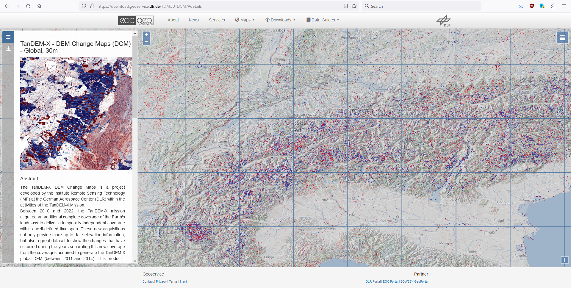
To get access to the products a self-registration is necessary with your personal address details, including a valid email address, and a user name.

For the order account generation you have to agree during the registration process to the Privacy Policy, the User License, and the Acceptable Use Policy of the download service, otherwise the account will not be generated, and downloading data will not be possible. You can find the Privacy Policy, the User License, and the Acceptable Use Policy as PDF documents here:


Privacy Policy

Data Protection Consent TanDEM-X 30m Edited DEM/DEM Change Maps Download Service for the automated processing of personal data as part of the provision of Digital Elevation Model data / Terrain Model data from the TanDEM-X Mission

User License
Licensing Agreement regarding the use of the TanDEM-X 30m Edited DEM and the DEM Change Maps data product

Acceptable Use Policy and Conditions of Use ("AUP")
DLR Earth Observation Center Geoservice Acceptable Use Policy and Conditions of Use ("AUP")


General Workflow

  • Register on the registration page with a valid email address to get a user name and password. Fill in the required fields and submit the registration form, and follow the instructions for verification of your email address. Old accounts in geoservice cannot be used for downloading the TanDEM-X 30m Products. With this account you can download both, the EDEM, as well as the DCM products.
  • Login with your credentials (user name and password) to the EOC download service.
  • Use the HTTPS server to download single files, or utilize a command line tool to recursively download the complete global data set(s). Or, alternatively, use the map driven interface to download single products for smaller regions of interests.


How to Register

  1. Go to https://sso.eoc.dlr.de/tdm30-edited/selfservice/register
  2. Fill in the required fields and complete the form.
  3. Click on "Continue", and the verification form appears
  4. An e-mail with a verification code will be sent to your email account. Copy the code from the email into the verification form. Please make sure that your e-mail program does not block the confirmation e-mail, have a look in your spam/unknown folder.
  5. The privacy policy, the User License, and the Acceptable Use Policy are to be accepted by the user, then the account is configured automatically.
  6. An additional email containing the documents of the accepted Privacy Policy, the User License, and the Acceptable Use Policy in PDF format will be sent.


Downloading Products

For downloading TanDEM-X 30m Edited DEM/ DEM Change Maps products two options via HTTPS encrypted connections are supported and a login with your user name and password (from the self-registration described above) is mandatory. FTP methods are not provided.

  1. Variant A: HTTPS Web browser & map-based interface for selecting individual geocells or retrieving the geocell link and automate download via clients/command line tools.
  2. Variant B: HTTPS Web browser interface for selecting individual geocells directly by browsing the directory structure, or by automated downloads via clients/command line tools.


Variant A – Using a HTTPS Web browser & map-based interface
This download option is recommended for users who wish to download a few products and who prefer the usage of a map driven interface for the selection of the products. For downloading few geocells known by name or the complete global data set, we recommend the usage of a client/command line tool (see Variant B below).

  1. Go to the login form at URL:
    https://sso.eoc.dlr.de/tdm30-edited/selfservice/login
    Login by entering your username and password you have registered with, and submit the login form
  2. Enter the URL of the map interface in a new web browser tab:

    1. For the TanDEM-X 30m Edited DEM (EDEM):
      https://download.geoservice.dlr.de/TDM30_EDEM/
    2. For the TanDEM-X 30m DEM Change Maps (DCM):
      https://download.geoservice.dlr.de/TDM30_DCM/


    Geoservice Start Page after login

    This page will appear with basic information about the TanDEM-X mission on the left and the map interface (showing a hill-shade color-coded version of the TanDEM-X EDEM) with the polygon outline for each individual DEM geocell on the right. The layer(s) to be depicted in the map can be selected by clicking the icon in the top right corner. Zoom to your region of interest, if needed.


  3. Select the desired geocells (=left-click with the mouse on the corresponding geocell). The name of the product geocell appears in a list on the left side.

    Geoservice DEM Tile selected

    Alternatively, you can also draw a search rectangle in order to download the products for a larger region of interest. Press the CTLR key on your keyboard while left-clicking with the mouse on a point and drag and draw the rectangle on the map. The rectangle will be closed and the geocells will be selected, by releasing the mouse button. Selected geocells appear on the left side of the page. You can remove single items from the list by selecting the trash bin icon associated which each item.

    Geoservice DEM Tiles selected by rectangle

  4. After the desired geocells have been selected, they can be saved on your computer file by file by clicking on the download icon associated to each item. If you are not logged in to this point, then the login page will be shown.

  5. Automated download for larger areas: If you want to automate the download of a larger area you can select the ‘List’ icon to save the download list to an ASCII text file (with an absolute pathname for each file per line), or you can select the metalink icon to save the file list to an XML-like metalink file.

    Geoservice save file list

    The ASCII file list can then be fed to a command line FTP client (e.g. wget or cURL, which are included in numerous Linux distributions, but are also available for Windows OS), or to a download manager (e.g. aria2). The following code examples will illustrate the usage of those command line tools. The final line of code might need some adaptions with respect to individual system settings (e.g. whether a proxy is needed), but might serve as a starting point.

    Suppose you have saved the list to the name ‘TDM30mDEM-url-list.txt’ to your current working directory and the download directory will be the current working directory as well, then the wget command would be the following one-liner (Windows OS, CMD command line):

    wget -i TDM30mDEM-url-list.txt --auth-no-challenge --user=username --ask-password


    The cURL command line (Linux OS) would be:
    curl $(printf ' -O %s' $(<TDM30mDEM-url-list.txt)) -u 'username:password'

    or, alternatively (Linux OS)

    xargs -a TDM30mDEM-url-list.txt -L1 curl -O -u 'username:password'


    The aria2 command line would be:

    aria2c -i TDM30mDEM-url-list.txt --http-user 'username' --http-passwd 'password'


    The metalink XML file can be fed to a download manager tool (e.g. aria2). Suppose you have saved the metalink to the file name ‘TDM30.meta4’ in your current working directory, then the command line for aria2 would be:

    aria2c -M TDM30.meta4 --http-user 'username' --http-passwd 'password'


  6. For the TanDEM-X 30m DEM Change Maps products the map interface provides the same functionality as for the EDEM products.

    Geoservice DCM start sceen

    Please note that by clicking on one geocell you are selecting 2 zip files offered for download: one zip file for the first, and one zip file for the last change map, as shown below.

    Geoservice DCM start sceen


Variant B: Using a web browser to access the download directories directly/using a client command line tool for bulk downloading

You can directly inspect and download single files by entering the download server location in a web browser; you will be prompted to login and to enter your credentials.

Alternatively go to the login form at URL:
https://sso.eoc.dlr.de/tdm30-edited/selfservice
Login by entering your username and password you have registered with, and submit the login form.

Enter the URL of the download server in a new web browser tab:

  1. For the TanDEM-X 30m Edited DEM (EDEM):
    https://download.geoservice.dlr.de/TDM30_EDEM/files/
  2. For the TanDEM-X 30m DEM Change Maps (DCM):
    https://download.geoservice.dlr.de/TDM30_DCM/files/

Hierarchical Directory Structure

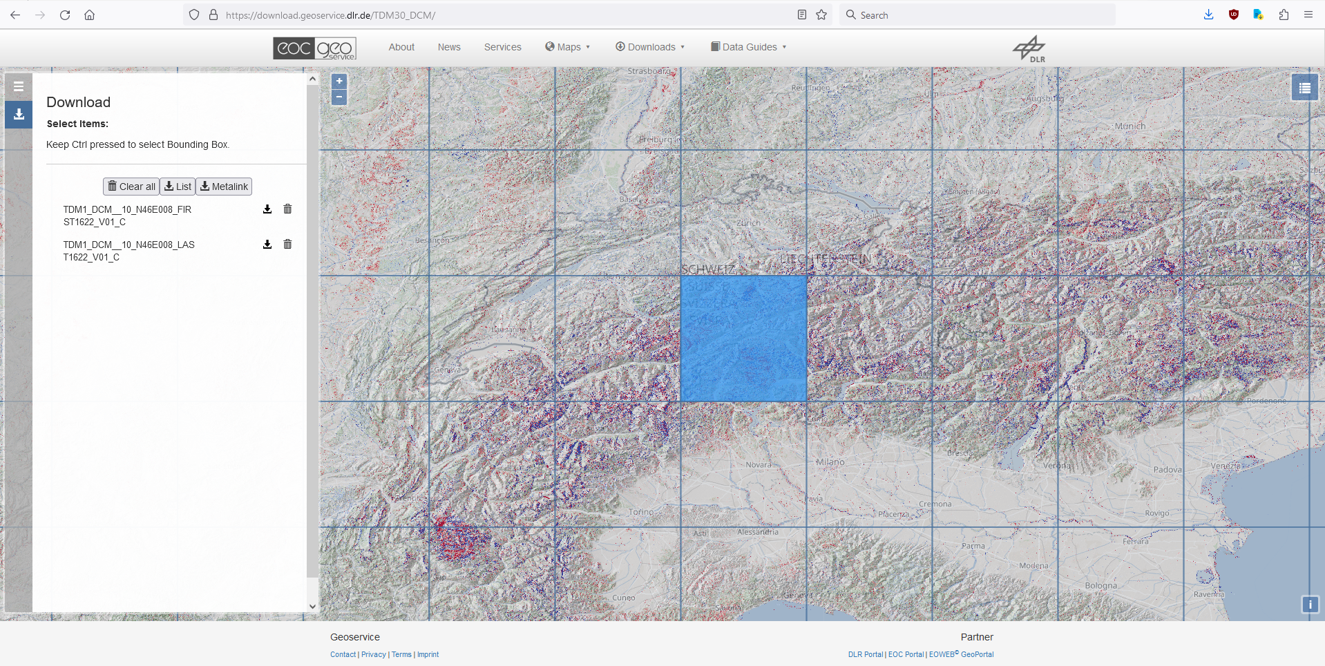
The main “/files” directory of the EDEM as well as the DCM server contain subdirectories. The first subdirectory level is based on latitudes, one separate directory for each latitude value; each latitude subdirectory is subdivided into further subdirectories for the longitude spaced by 10 degree. Only subdirectories actually containing EDEM or DCM tiles are visible.


Example: the directory ‘‘/TDM1_EDEM_10_N49/TDM1_EDEM_10_N49E010' contains the following 10 subdirectories:

TDM1_EDEM__10_N49E010_V01_C
TDM1_EDEM__10_N49E011_V01_C
TDM1_EDEM__10_N49E013_V01_C
TDM1_EDEM__10_N49E014_V01_C
TDM1_EDEM__10_N49E015_V01_C
TDM1_EDEM__10_N49E016_V01_C
TDM1_EDEM__10_N49E017_V01_C
TDM1_EDEM__10_N49E018_V01_C
TDM1_EDEM__10_N49E019_V01_C

The final product directories contain both, all unpacked files belonging to the products, as well as a zipped version including all files. To save download time we recommend to download the zip files only.


Recursively download the whole data set with a client

The complete global data set can be downloaded non-interactively using a client program like wget, which is provided with many Linux distributions as well with Apple OS, but can also be utilized for Windows OS. A source can be found by an internet search using “wget Windows 32 bit”, or “wget Windows 64 bit” for the latest Windows OS versions. In principal it is sufficient to simply download and copy the wget.exe into your current working directory. Please refer to the internet sources, if you want to start wget from any directory. For this task you need admin rights on your machine, and need to learn the handling of windows path variables.
Open the windows command line terminal (CMD), and browse to your current directory, where you have placed the wget.exe file. In order to download the complete global EDEM data set in your current working directory, limiting to the zip files only and preserving the hierarchical directory structure, use for example:

wget --user=your_username --auth-no-challenge --ask-password --no-parent -A "*.zip" -r https://download.geoservice.dlr.de/TDM30_EDEM/files/

If the hierarchical directory structure is not needed you can use the keyword ‘--no-directories’. All the zip files are copied directly in your current working directory:

wget --user=your_username --auth-no-challenge --ask-password --no-parent -A "*.zip" --no-directories -r https://download.geoservice.dlr.de/TDM30_EDEM/files/

Compatibility Issues with other Height Data Sets

For a joint processing with other height data the compatibility of the horizontal as well as the vertical reference has to be assured, otherwise positional and/or vertical offsets with a magnitude up to decameter range might show up. Hence, a transformation or even a chain of transformations towards compatibility is needed in the most cases, whose complexity level depends on the target system, and starts with the question in which horizontal (=positional) AND vertical (=height) reference system is the data set in. An exact knowledge of both reference systems is mandatory.

The TanDEM-X 30m Edited DEM is given in ellipsoidal heights (height over the WGS84 ellipsoid) as well as in orthometric heights (heights over the geoid EGM2008).


Ellipsoidal Height

Ellipsoidal height is purely geometric definition of height and is the distance measured along the normal of a reference ellipsoid to the point on the Earth surface. The vertical datum of the TanDEM-X 30m DEM data set is the WGS84 ellipsoid, hence the height values given by the TanDEM-X 30m DEM data sets are heights above the ellipsoid or ellipsoidal heights. If the ellipsoid of the reference height data sets is not the WGS84 ellipsoid, which is mostly true for the majority of national height data sets, then a datum transformation in three-dimensional Cartesian space is required. For small- and mid-scale mapping application e.g. a 7 parameter Helmert transformation (3 translation parameters, 3 rotation parameters, 1 scale factor) might be sufficient and is mostly integrated into common GIS software. For higher accuracy levels please contact your cadastral authority to obtain improved parameter sets for this task.

For national height systems two basic concepts of physical height definition based on the gravity field of the earth are widely used: orthometric height, or normal height.


Orthometric Height

Orthometric height is the distance along the plump line from a surface point to a reference geoid. The geoid is a surface based on the gravity potential and derived from gravity measurements, but assumptions about the Earth mass density distribution are required. The mean sea level (MSL) approximates best the geoid.

Please note in this context that the height values represented by other freely available global/near global height data sets (SRTM 1-arcsec, ASTER GDEM2, ALOS World 3D) are referenced to a geoid instead of an ellipsoid, and their height values have to be considered as orthometric heights. The relation between ellipsoidal height and orthometric height is given by:


h = H + N 


where
h: Ellipsoidal Height
H: Orthometric Height
N: Geoid-Height


The geoid model used for global/near global height data sets is in the most cases either the global EGM96, or the EGM2008 geoid, which both can be easily found and downloaded by a global internet search. Please check the documentation of your reference DEM data set, which geoid model is in use. If the pixel spacing of DEM and geoid model is not equal, bilinear interpolation should be used for resampling of geoid undulations. The conversion from ellipsoidal to orthometric height or vice versa is simple math given the formula above.


Normal Height

The alternative concept of normal height does not use any hypothesis about the Earth mass density distribution, but refers in addition to the local reference ellipsoid, and originates historically from terrestrial levelling practice before the rise of the satellite geodesy age and is widely used in European countries. The theoretical reference plane related to normal heights is called quasi-geoid. The relation between ellipsoidal heights and normal heights is given by the formula:


h = HN +  ζ


where

h:  Ellipsoidal Height
HN:  Normal Height
ζ:  Quasi-Geoid-Height


The difference between the orthometric height and the normal height of a point is not dramatic and is usually in the range of some centimeters to decimeters, but can also reach 1.5m. Sources for adequate geoid or quasi-geoid models are usual the national cadastral authorities (e.g. in Germany the Federal Agency for Cartography and Geodesy, BKG).


Frequently Asked Questions

Coming Soon...


Further Reading: Acknowledegements/Literature/Weblinks


Acknowledgements:

To acknowledge the scientists, who have generated and provided the TanDEM-X 30m Edited DEM and its layers, we request that users include the corresponding bibliographic citation in their work. Following references shall be cited:

[R01] González, C., Bachmann, M., Bueso-Bello, J.-L., Rizzoli, P., Zink, M. (2020): A Fully Automatic Algorithm for Editing the TanDEM-X Global DEM. Remote Sensing, 2020, 12(23):3961. https://doi.org/10.3390/rs12233961

[R02] Bueso-Bello, J.-L., Martone, M., González, C., Sica, F., Valdo, P., Posovszky, P., Pulella, A., Rizzoli, P. (2021): The Global Water Body Layer from TanDEM-X Interferometric SAR Data. Remote Sensing, 2021, 13(24):5069. https://doi.org/10.3390/rs13245069

[R03] Martone, M., Rizzoli, P., Wecklich, C., Gonzalez, C., Bueso-Bello, J.-L., Valdo, P., Schulze, D., Zink, M., Krieger, G., Moreira, A. (2018): The Global Forest/Non-Forest Map from TanDEM-X Interferometric SAR Data, Remote Sensing of Environment, vol. 205, pp. 352-373, Feb. 2018


To acknowledge the scientists, who have generated and provided the TanDEM-X DEM Change Maps Product and its layers, we request that users include the corresponding bibliographic citation in their work. Following references shall be cited:


[R04] Lachaise, M., Schweißhelm, B. (2023): TanDEM-X 30m DEM Change Maps Product Description, Issue Public Document TD-GS-PS-0216 Issue 1.0, 12.10.2023

[R05] Lachaise, M., González, C., Rizzoli P., Schweißhelm, B., Zink, M. (2022): The New Tandem-X DEM Change Maps Product, IGARSS 2022 - 2022 IEEE International Geoscience and Remote Sensing Symposium, Kuala Lumpur, Malaysia, 2022, pp. 5432-5435, doi: 10.1109/IGARSS46834.2022.9883612


Literature

[R06] Wessel, B., Huber, M., Wohlfart, C., Marschalk, U., Kosmann, D., Roth, A.(2018): Accuracy Assessment of the Global TanDEM-X Digital Elevation Model with GPS Data.
ISPRS Journal of Photogrammetry and Remote Sensing. Vol. 139, pp. 171-182.


[R07] Rizzoli, P., Martone, M., Gonzalez, C., Wecklich, C., Borla Tridon, D., Bräutigam, B., Bachmann, M., Schulze, D., Fritz, T., Huber, M., Wessel, B., Krieger, G., Zink, M., and Moreira, A. (2017): Generation and performance assessment of the global TanDEM-X digital elevation model.
ISPRS Journal of Photogrammetry and Remote Sensing, Vol 132, pp. 119-139.


[R08] Wessel, B. (2016): TanDEM-X Ground Segment – DEM Products Specification Document. EOC, DLR, Oberpfaffenhofen, Germany, Public Document TD-GS-PS-0021, Issue 3.2, 2016. [Online]. Available: https://tandemx-science.dlr.de/


[R09] Zink, M., Bachmann, M., Bräutigam, B., Fritz, T., Hajnsek, I., Krieger, G., Moreira, A., Wessel, B., TanDEM X: The New Global DEM Takes Shape, IEEE Geoscience and Remote Sensing Magazine (GRSM), 2(2), pp. 8-23, 2014.


[R10] Krieger, G., Zink, M., Bachmann, M., Bräutigam, B., Schulze, D., Martone, M., Rizzoli, P., Steinbrecher, U., Antony, J.W., De Zan, F., Hajnsek, I., Papathanassiou, K., Kugler, F., Rodriguez Cassola, M., Younis, M., Baumgartner, S., López-Dekker, P., Prats, P., Moreira, A., 2013. TanDEM-X: a radar interferometer with two formation-flying satellites. Acta Astronaut. 89, 83-98. August-September.


[R11] Krieger, G., Moreira, A., Fiedler, H., Hajnsek, I., Werner, M., Younis, M., Zink, M., 2007. TanDEM-X: a satellite formation for high resolution SAR interferometry. IEEE Trans. Geosci. Rem. Sens. 45 (11), 3317-3341.


Weblinks

Further information, as well as proposal web forms for the higher resolution unedited DEM products (12m & 30m DEM product) at:
https://tandemx-science.dlr.de


vdatum: A freeware software tool with a graphical user interface for vertical (and horizontal) grid transformations, provided by the United States National Oceanic and Atmospheric Administration (NOAA):
https://vdatum.noaa.gov/welcome.html


Contact


The EOC Geoservice Team

For technical problems, e.g. with the registration, the HTTPS download, or with the download via map interface etc., please contact the EOC Geoservice via contact form:

https://geoservice.dlr.de/web/contact


The TanDEM-X Science Coordination

For general questions about the TanDEM-X 30m Edited DEM product, or other TanDEM-X data products, please contact the TanDEM-X Science Coordination via email:

tandemx-science@dlr.de


You can find further information, as well as a proposal web forms for the higher resolution DEM products (unedited 12m & 30m DEM product) at URL:

https://tandemx-science.dlr.de


AIRBUS Defence & Space

The exclusive commercial data exploitation rights for TerraSAR-X und TanDEM-X products are with the AIRBUS Defence & Space GmbH. TanDEM-X DEM products are marketed by AIRBUS under the name WorldDEM. You can find more information about the WorldDEM product portfolio and contact information here:

https://www.intelligence-airbusds.com