DLR
EOC
Enmap
Imagery
Hyperspectral
Level 0
Quicklooks
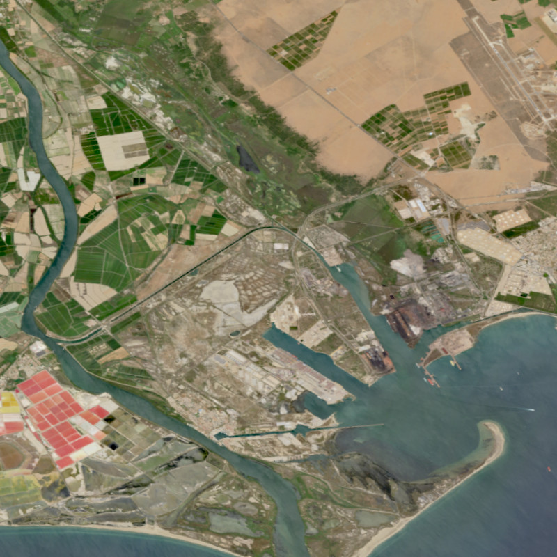
The EnMAP HSI L0 Quicklooks collection contains the VNIR and SWIR quicklook images as well as the quality masks for haze, cloud, or snow; based on the latest atmospheric correction methodology of the land processor. It allows users to get an overview which L0 data has been acquired and archived since the operational start of the EnMAP mission and which data is potentially available for on-demand processing into higher level products with specific processing parameters via the EOWEB-GeoPortal. The database is constantly updated with newly acquired L0 data.
The Environmental Mapping and Analysis Program (EnMAP) is a German hyperspectral satellite mission that monitors and characterizes Earth’s environment on a global scale. EnMAP delivers accurate data that provides information on the status and evolution of terrestrial and aquatic ecosystems, supporting environmental monitoring, management, and decision-making.
Items:
Visible and near-infrared (VNIR) quicklook radiometrically corrected for optimal displaying. Wavelength: 550 nm (blue), 670 nm (green), 850 nm (red)
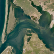
False color short-wavelength infrared (SWIR) quicklook radiometrically corrected for optimal displaying. Wavelength: 1050nm (blue), 1650nm (green), 2200nm (red)
EnMAP HSI L0 Quicklook Cloud
Title: EOC Imagery Map Service
Endpoint: https://geoservice.dlr.de/eoc/imagery/wms
Layer: ENMAP_HSI_L0_QL_QUALITY_CLOUD,ENMAP_HSI_L0_QL_FOOTPRINTS
Capabilities: GetCapabilities (XML)
Preview: GetMap (Openlayers)
EnMAP HSI L0 Quicklook Cloud Shadow
Title: EOC Imagery Map Service
Endpoint: https://geoservice.dlr.de/eoc/imagery/wms
Layer: ENMAP_HSI_L0_QL_QUALITY_CLOUDSHADOW,ENMAP_HSI_L0_QL_FOOTPRINTS
Capabilities: GetCapabilities (XML)
Preview: GetMap (Openlayers)
EnMAP HSI L0 Quicklook Cirrus
Title: EOC Imagery Map Service
Endpoint: https://geoservice.dlr.de/eoc/imagery/wms
Layer: ENMAP_HSI_L0_QL_QUALITY_CIRRUS,ENMAP_HSI_L0_QL_FOOTPRINTS
Capabilities: GetCapabilities (XML)
Preview: GetMap (Openlayers)
EnMAP HSI L0 Quicklook Classes
Title: EOC Imagery Map Service
Endpoint: https://geoservice.dlr.de/eoc/imagery/wms
Layer: ENMAP_HSI_L0_QL_QUALITY_CLASSES,ENMAP_HSI_L0_QL_FOOTPRINTS
Capabilities: GetCapabilities (XML)
Preview: GetMap (Openlayers)
EnMAP HSI L0 Quicklook Haze
Title: EOC Imagery Map Service
Endpoint: https://geoservice.dlr.de/eoc/imagery/wms
Layer: ENMAP_HSI_L0_QL_QUALITY_HAZE,ENMAP_HSI_L0_QL_FOOTPRINTS
Capabilities: GetCapabilities (XML)
Preview: GetMap (Openlayers)
EnMAP HSI L0 Quicklook Quality Snow
Title: EOC Imagery Map Service
Endpoint: https://geoservice.dlr.de/eoc/imagery/wms
Layer: ENMAP_HSI_L0_QL_QUALITY_SNOW,ENMAP_HSI_L0_QL_FOOTPRINTS
Capabilities: GetCapabilities (XML)
Preview: GetMap (Openlayers)
Related Datasets:
EnMAP HSI - Level 2A Hyperspectral Images - Global
2022-10-10