DLR
EOC
MODIS-EU
Orthoimagery
TERRA
AQUA
Europe
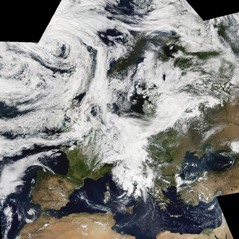
The Moderate Resolution Imaging Spectroradiometer (MODIS) is a key instrument aboard the American satellites Terra and Aqua. The MODIS-EU image mosaic is a seamless true color composite of all Terra and Aqua passes received at DLR during one day. Daily and Near Real Time (NRT) products are available. For the composite, MODIS channels 1, 4, 3 are used. The channels are re-projected, radiometrically enhanced, and seamlessly stitched to obtain a visually appealing result.
Terra passes from north to south across the equator in the morning, while Aqua passes the equator south to north in the afternoon. Both MODIS instruments are viewing the entire Earth surface every 1 to 2 days, acquiring data in 36 spectral bands. These data will improve our understanding of global dynamics and processes occurring on the land, in the oceans, and in the lower atmosphere. MODIS is playing a vital role in the development of validated, global, interactive Earth system models able to predict global change accurately enough to assist policy makers in making sound decisions concerning the protection of our environment.
Items:
MODIS (or Moderate Resolution Imaging Spectroradiometer) is a key instrument aboard the Terra (EOS AM) and Aqua (EOS PM) satellites. Terra's orbit around the Earth is timed so that it passes from north to south across the equator in the morning, while Aqua passes south to north over the equator in the afternoon. Terra MODIS and Aqua MODIS are viewing the entire Earth's surface every 1 to 2 days, acquiring data in 36 spectral bands, or groups of wavelengths (see MODIS Technical Specifications). These data will improve our understanding of global dynamics and processes occurring on the land, in the oceans, and in the lower atmosphere. MODIS is playing a vital role in the development of validated, global, interactive Earth system models able to predict global change accurately enough to assist policy makers in making sound decisions concerning the protection of our environment (from http://modis.gsfc.nasa.gov/).
MODIS (or Moderate Resolution Imaging Spectroradiometer) is a key instrument aboard the Terra (EOS AM) and Aqua (EOS PM) satellites. Terra's orbit around the Earth is timed so that it passes from north to south across the equator in the morning, while Aqua passes south to north over the equator in the afternoon. Terra MODIS and Aqua MODIS are viewing the entire Earth's surface every 1 to 2 days, acquiring data in 36 spectral bands, or groups of wavelengths (see MODIS Technical Specifications). These data will improve our understanding of global dynamics and processes occurring on the land, in the oceans, and in the lower atmosphere. MODIS is playing a vital role in the development of validated, global, interactive Earth system models able to predict global change accurately enough to assist policy makers in making sound decisions concerning the protection of our environment (from http://modis.gsfc.nasa.gov/).
Related Datasets:
MODIS-DE Mosaic
2011-01-13