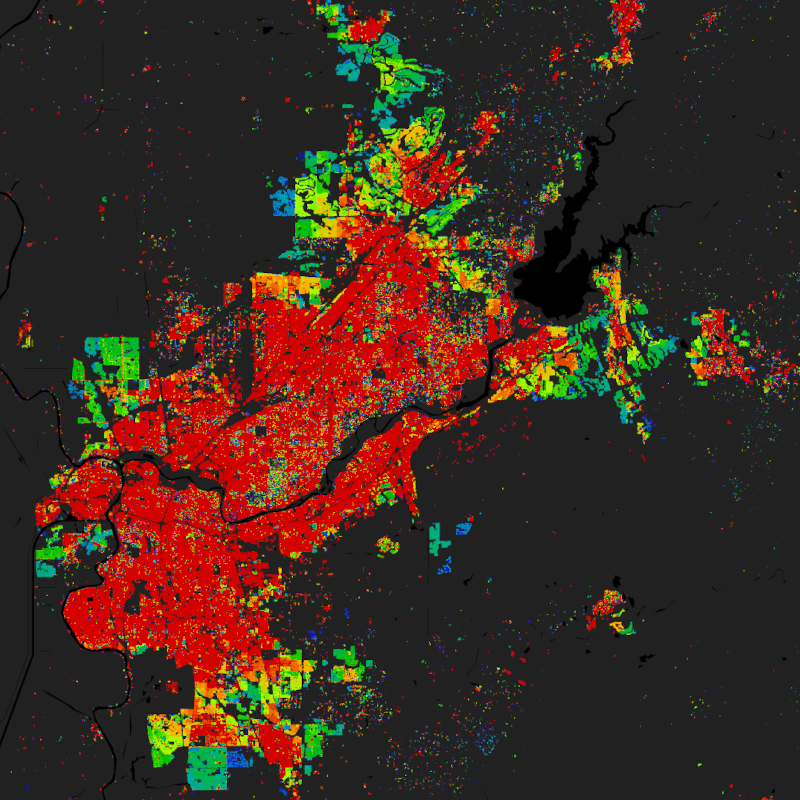
The World Settlement Footprint (WSF®) Evolution is a 30m resolution dataset outlining the global settlement extent on a yearly basis from 1985 to 2015.
Based on the assumption that settlement growth occurred over time, all pixels categorized as non-settlement in the WSF2015 (Marconcini et al., 2020) are excluded a priori from the analysis. Next, for each target year in the past, all available Landsat-5/7 scenes acquired over the given area of interest are gathered and key temporal statistics (i.e., temporal mean, minimum, maximum, etc.) are then extracted for different spectral indices. Among others, these include: the normalized difference built-up index (NDBI), normalized difference vegetation index (NDVI) and modified normalized difference water index (MNDWI). Temporal features proved generally robust if computed over at least 7 clear cloud-/cloud-shadow-free observations; accordingly, if for a given pixel in the target year this constraint is not satisfied, the time frame is enlarged backwards (at 1-year steps) as long as the condition is met.
Starting backwards from the year 2015 - for which the WSF2015 is used as a reference - settlement and non-settlement training samples for the given target year t are iteratively extracted by applying morphological filtering to the settlement mask derived for the year t+1, as well as excluding potentially mislabeled samples by adaptively thresholding the temporal mean NDBI, MNDWI and NDVI. Finally, binary Random Forest classification in performed.
To quantitatively assess the high accuracy and reliability of the dataset, an extensive campaign based on crowdsourcing photointerpretation of very high-resolution airborne and satellite historical imagery has been performed with the support of Google. In particular, for the years 1990, 1995, 2000, 2005, 2010 and 2015, ~200K reference cells of 30x30m size distributed over 100 sites around the world have been labelled, hence summing up to overall ~1.2M validation samples.
It is worth noting that past Landsat-5/7 availability considerably varies across the world and over time. Independently from the implemented approach, this might then result in a lower quality of the final product where few/no scenes have been collected. Accordingly, to provide the users with a suitable and intuitive measure that accounts for the goodness of the Landsat imagery, we conceived the Input Data Consistency (IDC) score, which ranges from 6 to 1 with: 6) very good; 5) good; 4) fair; 3) moderate; 2) low; 1) very low. The IDC score is available on a yearly basis between 1985 and 2015 and supports a proper interpretation of the WSF evolution product.
The WSF evolution and IDC score datasets are organized in 5138 GeoTIFF files (EPSG4326 projection) each one referring to a portion of 2 x 2 degree size (~222 x 222 km) on the ground. WSF evolution values range between 1985 and 2015 corresponding to the estimated year of settlement detection, whereas 0 is no data. A comprehensive publication with all technical details and accuracy figures is currently being finalized. For the time being, please refer to Marconcini et al,. 2021.