Skip navigation

Release of the World Settlement Footprint (WSF) 2019 and Evolution

Nov 15, 2021

The World Settlement Footprint (WSF) 2019 and Evolution are global maps of human settlements which have been generated by means of an advanced classification technique that jointly exploits multi decadal open and free optical and radar imagery. While the World Settlement Footprint (WSF) 2019 is a 10m resolution binary mask outlining the extent of human settlements globally derived by means of 2019 multitemporal Sentinel-1 and Sentinel-2 imagery, the World Settlement Footprint Evolution depicts the global settlement extent on a yearly basis from 1985 to 2015 at a spatial resolution of 30 meters. The dataset can be visualized in the EOC Geoservice Webapp [1] [2] and can also be downloaded from the EOC Download Service [3] [4].

Release of the TanDEM-X PolarDEM 90m of Antarctica

Dec 11, 2020

The TanDEM-X PolarDEM 90m of Antarctica is a gap-free digital elevation model (DEM) product of Antarctica generated from the TanDEM-X mission in 90 meter resolution. The DEM product was derived from the global TanDEM-X DEM undergoing a gap-filling process with additional TanDEM-X acquisitions and an editing especially of noisy ocean values. The DEM represents elevation values mainly from data acquired in 2013 and 2014. The TanDEM-X PolarDEM is a project developed by the German Remote Sensing Data Center (DFD) at the German Aerospace Center (DLR) within the activities of the TanDEM-X mission. It is a framework for the provision of derivatives of the global Digital Elevation Model (DEM) of the TanDEM-X mission for Polar Regions [1]. The dataset can be visualized in the EOC Geoservice Webapp [2] and after registration, also be downloaded from the EOC Download Service [3].

Release of TimeScan Landsat data

Nov 4, 2020

The TimeScan Landsat 2015 layer [1, 2] is a higher-processing level baseline product providing a harmonized representation of the spectral and temporal properties of the land surface. The global TimeScan Landsat 2015 dataset was derived from over 450,000 Landsat-8 images (~500TB) collected from 2013 to 2015. The product condenses the information content of the original images to a 20th of their original size. The TimeScan Landsat 2015 layer can be analyzed in the form of a single, global, cloud-free dataset based on statistical ranges of 6 indices for such aspects as the state of vegetation, water cover, or human settlement (built-up areas). For each of the recorded indices the statistics provide the minimal, maximal and mean values along with the standard deviation and the mean slope determined for the entire period from 2013 to 2015. The TimeScan procedure is designed to help end users exploit information from masses of data that until now were too unwieldy for them to handle.

Release of MetOp-C GOME-2 data

May 27, 2020

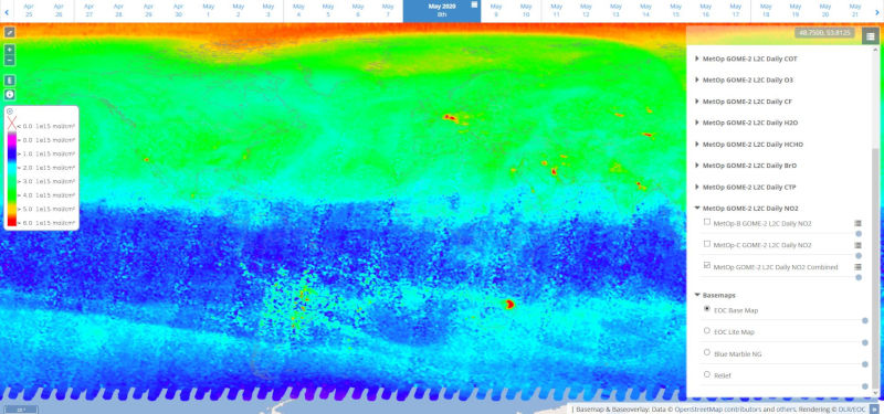
The EOC Geoservice map context "MetOp GOME-2 Daily Total Column Composites" [1] shows composites calculated from daily products of different trace gases and cloud properties measured by the "Global Ozone Monitoring Experiment-2" (GOME-2) instruments onboard EUMETSAT's MetOp satellite series. The products data stream has now been accomplished by EUMETSAT's MetOp-C satellite unit which was launched in November 2018 and secures the future data flow at least until the year 2025. Please see the according news release [2] for further information.

In addition to the introduction of MetOp-C, the following changes have been performed to the MetOp GOME-2 WMS/WCS services:

  • The publication of MetOp-A maps in the Geoservice ended on 2020-04-07 and is superseded by MetOp-C.
  • The publication of MetOp-AB maps (combined composite products of MetOp-A and MetOp-B) ended on 2020-04-07 and is superseded by combined products using data from MetOp-B and MetOp-C. The existing older MetOp-AB and new MetOp-BC products are now available in a new "Combined" map layer as a continuous time-series.
  • NRT-products are no longer available as separate "LATEST/PREVIOUS"-layers, but are now included in the regular layers of the Daily ("P1D") products.

The new layer names and titles are defined using the following schema:

MetOp-B/C GOME-2:
Layer Name: METOP-[B/C]_GOME-2_L2C_P1D_[PARAMETER]
Layer Title: MetOp-[B/C] GOME-2 L2C Daily [PARAMETER]

MetOp GOME-2 Combined:
Layer Name: METOP_GOME-2_L2C_P1D_COMB_[PARAMETER]
Layer Title: MetOp GOME-2 L2C Daily [PARAMETER] Combined

The collections can be visualized in the EOC Geoservice Webapp [1] and accessed via OGC web services [3] [4].

New EOC Download Service available

Sep 26, 2018

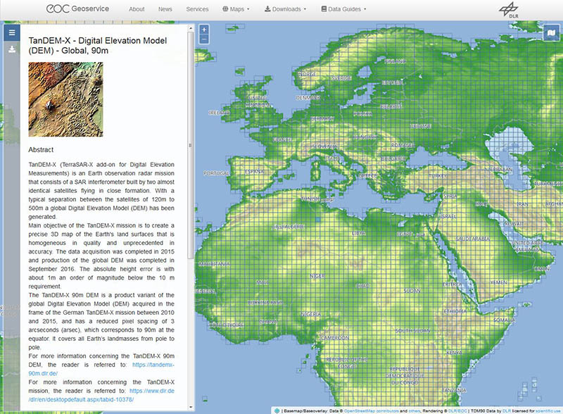
Concurrent with the publication of the TanDEM-X 90m digital elevation model (DEM), the new EOC Download Service has been introduced. Using the new service, raster data provided by the EOC Geoservice can be downloaded with just a few mouse clicks through an easy-to-use webinterface. Besides the TanDEM-X 90m DEM [1], also SRTM X-SAR elevation data [2] are made available with the initial release of the new service. Further datasets will follow.

TanDEM-X 90m Digital Elevation Model released

Sep 26, 2018

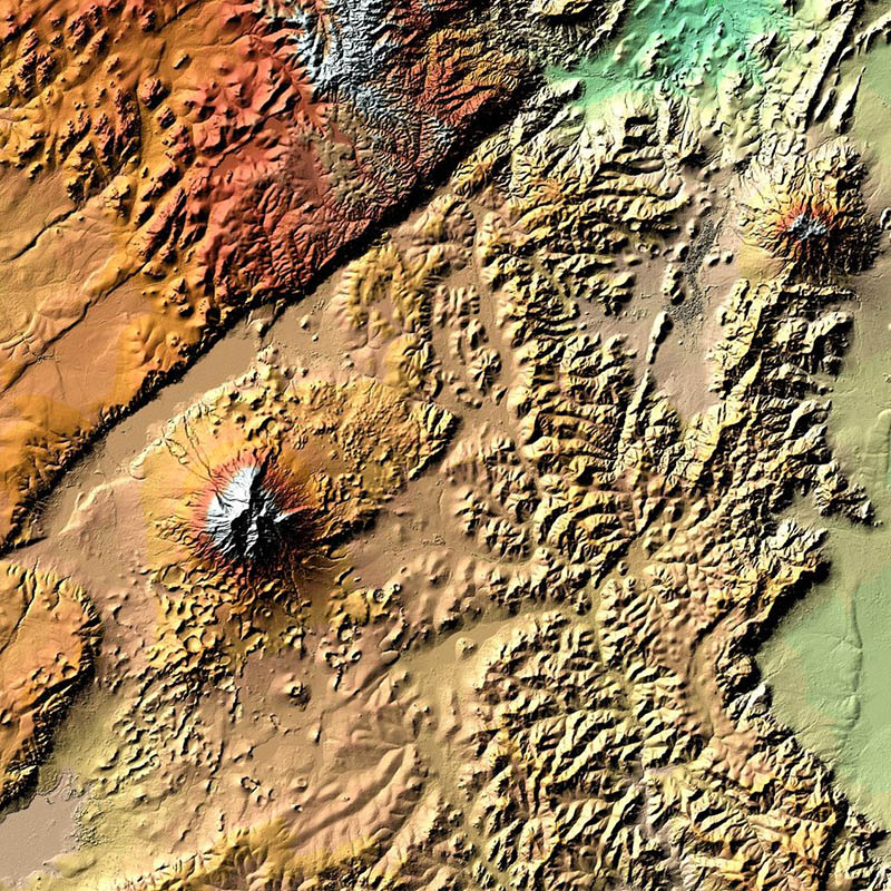
On 28 September 2018, DLR has released the global elevation model of the TanDEM-X mission in 90 meter resolution to the public. After registration, the data set can be downloaded free of charge from DLR EOC's new download service [1]. In addition, the eight original TanDEM-X information layers are provided via OGC web services [2, 3] and can be visualized in the EOC Geoservice Webapp [4].

Extended Timeseries Support

May 9, 2018

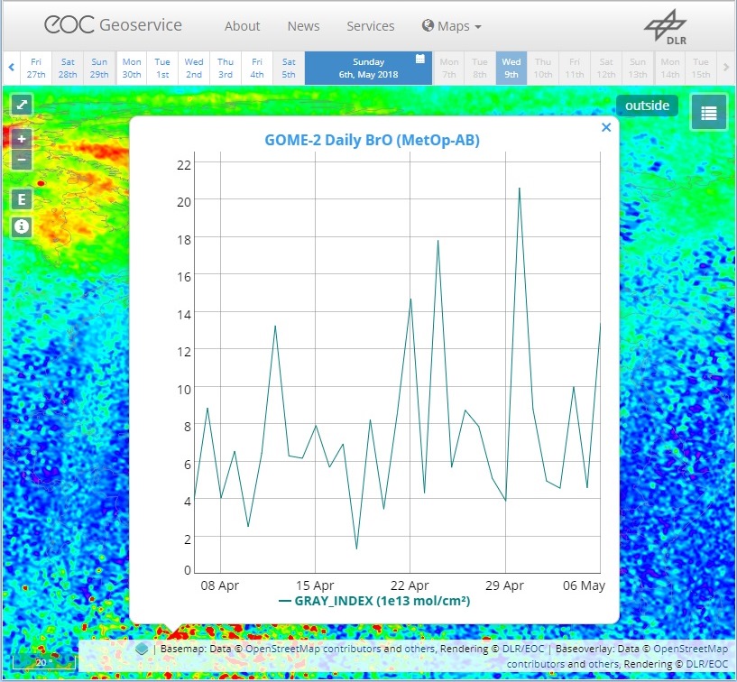
The EOC Geoservice now supports requesting timeseries for all temporal enabled layers via the GeoServer ncWMS extension [1], [2]. Additionally, the map pages now include basic support for the GeoTimeSeries operation and plotting of interactive timeseries graphs. It can be activated by double-clicking on the map. This will request a graph representing the latest 30 days for daily layers and latest 12 months for monthly layers. Together with the already supported animation capabilities of GeoServer [3], users now have more advanced possibilities to visualise temporal datasets [4].

AVHRR - Monthly Mediterranean Sea Surface Temperature (SST)

May 8, 2018

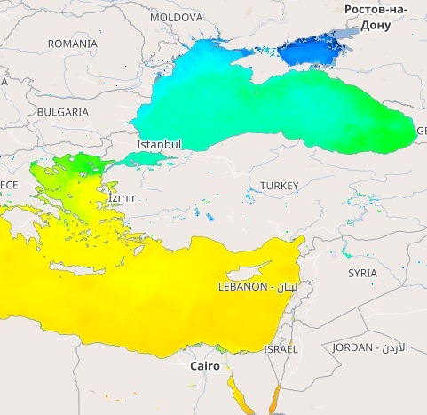
D-SDA has been archiving data of the Advanced Very High Resolution Radiometer (AVHRR) on board of the National Oceanic and Atmospheric Administration (NOAA) fleet of Polar Operational Environmental Satellites (POES) since 1983. For three decades DLR has been generating and archiving regional coverages of daily AVHRR level 3 products such as vegetation index, sea surface temperature and land surface temperature. D-SDA is now making available a subset of its AVHRR level 3 data archive via geospatial web services provided by the EOC Geoservice. "AVHRR - Monthly Mediterranean SST" is an AVHRR subset from 1993 to 2014 integrated in the EOC Geoservice to facilitate valuable time series exploitation of historic data. Additionally, integrating these data serves as a prototype for the DLR "TIMELINE" project.

Global Urban Footprint® dataset released

Dec 14, 2016

The Global Urban Footprint® (GUF®) database shows the human settlements patterns in urban and rural environments in a so far unprecedented spatial resolution of about 12m per raster cell (0.4 arcseconds). A second version of the product is available in 2.8 arcseconds raster cell resolution (about 84 m). The GUF® dataset is based on the radar (SAR) satellite imagery of the German satellites TerraSAR-X and TanDEMr-X. It reflects the distribution of vertical built-up structures around the year 2012, with 93% of the satellite images recorded in 2011 and 2012, and remaining data gaps filled in 2013 and 2014.

Global SnowPack datasets released

Nov 15, 2016

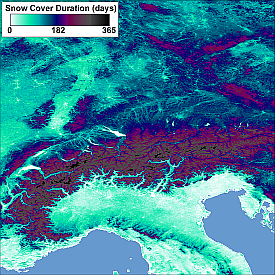
The Global SnowPack is a set of snow cover parameters made available on a global scale. It is based on daily, medium resolution remote sensing datasets (MOD10A1 and MYD10A1) provided by the National Snow and Ice Data Center (NSIDC). The data was reprocessed to clear data gaps caused by clouds and polar darkness and now informs about snow cover duration as well as early and late season snow cover duration for each hydrological year (September 1st of a calendar year to August 31st of the subsequent year) since 2000.