DLR
TDM
HR
TanDEM-X
DEM
EDEM
Digital Elevation Model
TDM30
Edited DEM
TanDEM-X (TerraSAR-X add-on for Digital Elevation Measurements) is an Earth observation radar mission that consists of a SAR interferometer built by two almost identical satellites flying in close formation. With a typical separation between the satellites of 120 m to 500 m a global Digital Elevation Model (DEM) has been generated.
The TanDEM-X 30m EDEM is a product variant of the global Digital Elevation Model (DEM) acquired in the frame of the German TanDEM-X mission between 2010 and 2014, and has a reduced pixel spacing of 1 arcseconds (arsec), which corresponds to 30m at the equator. An automated edition was developed by the Microwaves and Radar Institute at the German Aerospace Center (DLR) to have a full and clean coverage of all Earth’s landmasses from pole to pole.
References:
- C. González, M. Bachmann, J.L. Bueso-Bello, P. Rizzoli, M. Zink. A Fully Automatic Algorithm for Editing the TanDEM-X Global DEM. Remote Sensing. 2020; 12(23):3961. DOI: 10.3390/rs12233961
- J.L. Bueso-Bello, M. Martone, C. González, F. Sica, P. Valdo, P. Posovszky, A. Pulella, P. Rizzoli. The Global Water Body Layer from TanDEM-X Interferometric SAR Data. Remote Sensing. 2021; 13 (24):5069. DOI: 10.3390/rs13245069
- M. Martone, P. Rizzoli, C. Wecklich, C. González, J.L. Bueso-Bello, P. Valdo, D. Schulze, M. Zink, G. Krieger, A. Moreira. The global forest/non-forest map from TanDEM-X interferometric SAR data. Remote Sensing of Environment. 2018; 205 : 352-373.
Items:
The EDEM elevation values, derived from the TanDEM-X mission and edited in order to remove voids and to flatten water, are given in ellipsoidal heights relative to the WGS84 ellipsoid in the WGS84-G1150 datum and WGS84-EGM08. Note that the abrreviation (EGM/W84) is related to the vertical datum.
The EDM is color-coded and shows where the DEM has been modified in order to fill gaps and flatten the water areas. The value for each pixel in the editing mask identifies a combination of the used edition algorithm and the external reference DEM, in the case of gaps filled with an external reference DEM.
The HEM is the standard deviation of the height error for each unedited pixel, associated to the pure InSAR derived DEM height combination noise.
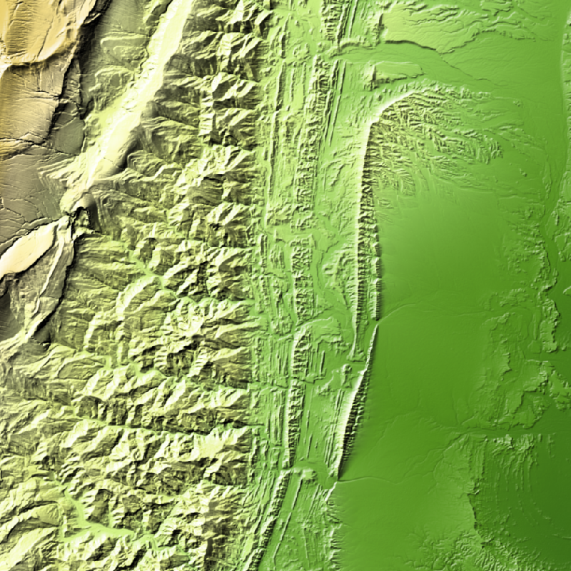
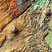
The hillshade generated from 16-bit EGM elevation values using a combination of slope and oblique shading.
The hill shade display is a color-coded 3D representation of the terrain surface, with the sun's relative position taken into account for shading the image.
The hill shade generated from 16-bit EGM elevation values using a combination of hillshading illuminated from 225 deg, 270 deg, 315 deg, and 360 deg azimuth.
The LCM is color-coded and shows pixel-wise land cover classification. The first band includes 3 LC classes: forest, land and water. In the second band, information about the reliability of the water LC class is provided, associated to permanent water and temporary water.
Related Datasets:

TanDEM-X 30m DEM Change Maps (DCM)
2023-11-15
TanDEM-X 90m DEM
2023-11-15

TanDEM-X PolarDEM 90m of Antarctica
2023-11-15